Satellite imagery shows the impact of Hurricane Maria on Puerto Rico
Hurricane Maria hit Puerto Rico on September 21, 2017. The below images show Puerto Rico before and after the storm.
 September 25, 2017
S-2A MSI courtesy of Copernicus
 September 15, 2017
S-2A MSI courtesy of Copernicus
The Arecibo region of Puerto Rico before (September 15th left) and after (September 25th right) Hurricane Maria. Images produced with data, courtesy of the Copernicus Programme, from the MultiSpectral Instrument (MSI) on board the Sentinel-2 satellite. [Full resolution images: S-2A MSI 09/15/2017 09/25/2017]
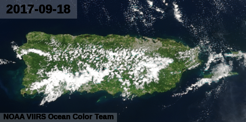
Images of Puerto Rico before and after Hurricane Maria produced using the Visible Infrared Imaging Radiometer Suite (VIIRS) on board the Suomi National Polar-Orbiting (SNPP) satellite.
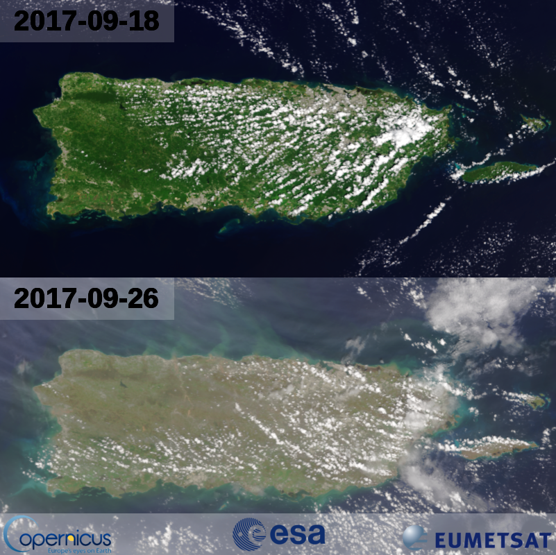
Images of Puerto Rico before and after Hurricane Maria produced using Ocean and Land Colour Instrument (OLCI) on board the Sentinel-3 satellite.