| CoastWatch Node |
Central
|
|---|---|
| Dates |
May 20-23
|
| Location |
College Park, MD
|
| NOAA Line Office | |
| Photo |
|
Summary
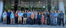
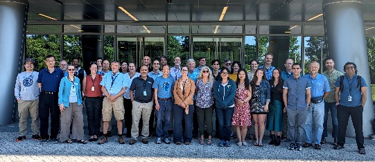
The 2024 NOAA CoastWatch (CW) Annual Meeting was held May 20-23, 2024, onsite at the NOAA Center for Climate and Weather Prediction (NCWCP) in College Park, MD, and online. The meeting featured updates from eight SOCD Science Teams, a detailed discussion on Sea Surface Temperature (SST) user needs, reports from CW Central, CW Regional and Thematic Nodes, and the Research and Applications Team, followed by extended group discussions.
The meeting opened with a NOAA-wide seminar by Drs. Paul DiGiacomo and Rost Parsons, detailing NOAA CoastWatch’s response to the 2022 Line Office User Needs Assessment and NESDIS' role in fulfilling long-term Sea Surface Temperature (SST) product requirements. The meeting concluded with a keynote on the Observing Air–Sea Interactions Strategy (OASIS) project by Dr. Meghan Cronin from NOAA Research. Attendees appreciated the unique sessions and the increased opportunities for interaction with the applications teams and line offices. Future meetings will aim to enhance these connections and promote better user engagement. The meeting session highlights are detailed below.
SST User Panel and Discussion
Dr. Rost Parsons (NCEI) presented the NESDIS SST Working Group’s final report.
STAR SST science teams showcased the latest advancements in the NESDIS Enterprise SST (Advanced Clear Sky Processor for Oceans SST) and the Geo-Polar Blended multi-satellite SST products.
- A Data Users Panel, including experts from academia and federal agencies, highlighted how NESDIS’ SST data supports environmental and public health decision-making. Summary report linked here.
The session concluded with a discussion of unmet user needs, particularly for coastal regions, and strategies for addressing data quality concerns within 1 km of coastlines and estuaries.
SOCD Science Teams
SOCD science teams shared research updates and new products including:
- The Multiparameter Eddy Significance Index (MESI) and MUNSTER (Multiparameter Near-real-time System for Tracking Eddy's Retroactively).
- New ice and polar products, in high demand by PolarWatch and the Great Lakes Node.
- Discussions of coastal and inland flooding products using Synthetic Aperture Radar (SAR) imagery, especially for the Chesapeake Bay.
- Updates on the Surface Water Ocean Topography (SWOT) and Phytoplankton Aerosol Cloud ocean Ecosystem (PACE) missions.
The Ocean Vectors Team will present at a future CW seminar.
CoastWatch Nodes
The Nodes highlighted:
- Improvements in hurricane and sargassum monitoring.
- Impacts of low ice-cover on the Great Lakes.
- Satellite observations using chlorophyll and temperature for fisheries management in the Chesapeake Bay.
- Providing inclusive and accessible science through Open Science.
- Net primary productivity in the West Coast.
- Benefits of using geostationary ocean color data to assess coral reef habitats.
The demonstration and planned expansion of Flood Inundation Mapping Services.
CoastWatch Applications Team
The CW Application Teams featured:
- Eight team member presentations on ongoing work in areas such as water quality monitoring, seagrass habitat suitability, primary productivity, and eddy tracking.
The Application Knowledge Hub, demonstrating the value of satellite imagery in freshwater and marine monitoring.
CoastWatch Central Operations
- CW by the numbers: CW distributed 33 million files in 2023, serving 260,000+ unique IP addresses.
- Conducted usability testing for the data portal map viewer in collaboration with the NESDIS User Engagements and Needs Assessment Branch. The identified conclusions were implemented to improve user experience.
Supported the CW Applications team on three projects: LIS SeaGrant project, Skylight collaboration for vessel detection in marine protected areas, and a multi-agency collaboration for chlorophyll monitoring for inland waters using Sentinel-2.
- Since 2020, CW continues to support the transition of VIIRS Ocean Color (i.e., STAR MSL12 processing, CoastWatch composites, and other unique products) into Operations in the NESDIS Common Cloud Framework (NCCF).
- Collaborated with NOAA Ocean Service to develop the use of hyperspectral PACE data for harmful algal bloom detection and monitoring.
Distributed the new ShipWatch application to NOAA Office of Marine and Aviation Operations OMAO ships. ShipWatch tracks NOAA vessels and provides select routine satellite data to their underway location.
Conclusions and Next Steps
- A draft of the CW Strategic Plan will be circulated for internal review.
- The quantitative and qualitative successes of CW courses and trainings were documented, highlighting the importance and value in continuing outreach initiatives. CW will continue to teach courses for identified user groups and host trainings at key conferences.
- The Sea Surface Height science team will be invited to upcoming CW meetings to provide workshops on developing and serving new altimetry products.
MESI and MUNSTER data will be shared with interested CW Node users (e.g., West Coast, OceanWatch Central Pacific). Feedback will be requested to inform the final product format.
- Identify opportunities to foster deeper engagement among the SOCD Science Teams and the CW Nodes and Applications Teams.