Purpose
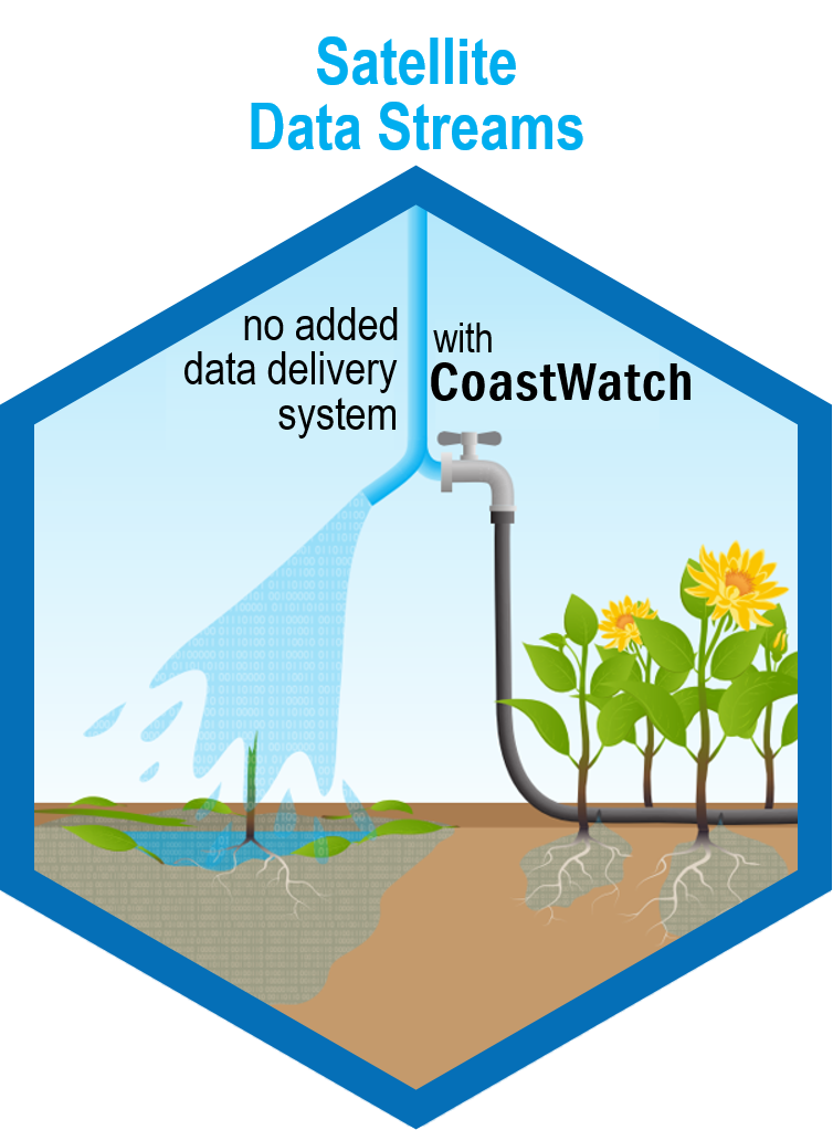 NOAA CoastWatch exists to help people find, choose, access, and use observations from satellites for ocean, coastal and inland water applications that inform and benefit society.
Mission Statement
NOAA CoastWatch connects people and applications to global and regional satellite data products for use in understanding, managing and protecting ocean and coastal resources and for monitoring and assessing impacts of change in ecosystems, weather, and the environment.
Objectives
- Be the interface between the users of satellite data products (and related in situ data) and satellite remote sensing science and algorithm development.
- Serve interested people, researchers, forecasters, decision-makers within NOAA and beyond NOAA.
- Provide data at global and regional spatial resolutions.
- Provide timely access to low latency data for near-real- time applications.
- Provide consistent access to high quality, long term time series data for climate and ecosystem research and applications.
- Produce, curate and provide tailored products for core constituent users.
- Educate and train users about using satellite data and CoastWatch products
- Innovate and develop new products derived from satellite observations, including products that fuse across multiple remotely sensed geophysical parameters.
- Collaborate in scientific research that exploits ocean, coastal and inland water satellite observations and products.

The Image That Started It All
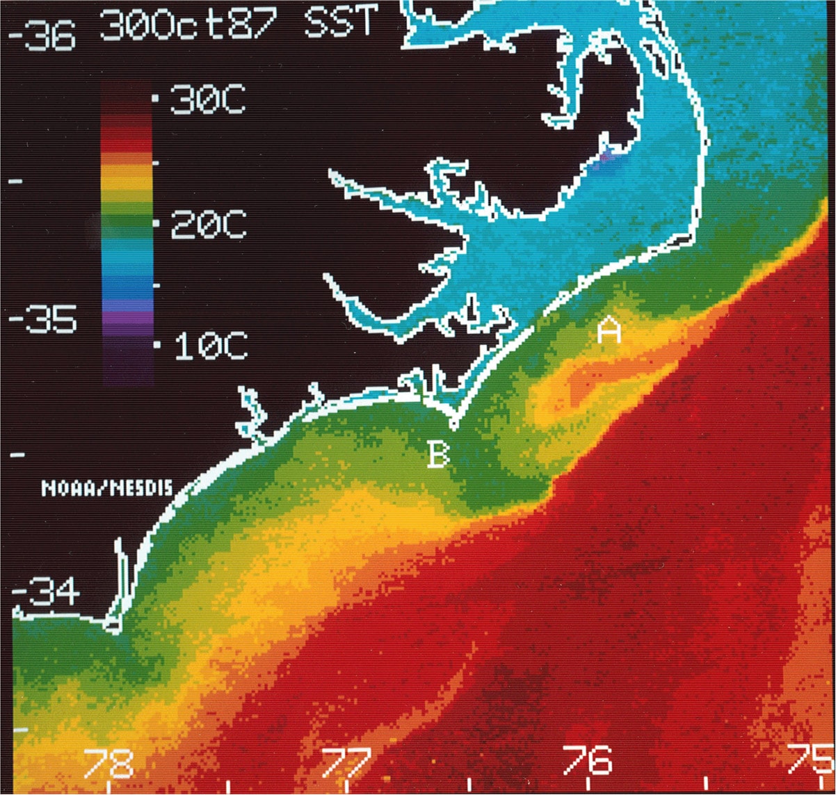
NOAA CoastWatch was established in response to two significant environmental events. A Harmful Algal Bloom (HAB) event in 1987 occurred off the coast of North Carolina transporting the toxic Karenia brevis (formerly known as Gymnodinium breve and Ptychodiscus brevis) cells from Florida via the Gulf Stream into the colder coastal waters near Cape Lookout. Also, a severe mammal die-off occurred, where more than 700 bottlenose dolphins died off the mid-Atlantic coast. Both instances prompted Federal and State officials to explore additional data sources for monitoring the coastal waters, such as near real-time satellite data.
Growth and Evolution
Initially serving our customers Sea Surface Temperature (SST) data for the East Coast from POES/AVHRR instruments, CoastWatch has now expanded to providing users moderate assurance service of a variety of environmental data (i.e. SST, ocean color, winds, etc.) and value added products and services from many NOAA and non-NOAA satellite platforms covering the globe, including the entire U.S. EEZ coastal waters, including Hawaii and Alaska, global ocean and polar (high latitude) products.
HAB Event
1987
A Harmful Algal Bloom (HAB) event known as the North Carolina Red Tide occurred on November 2. Toxic Karenia brevis cells traveled from Florida via the Gulf Stream into the colder coastal waters near Cape Lookout. This resulted in a loss of ~$25 million (~$64 million in 2022 dollars).
CoastWatch Established
1991
Starting with just Sea Surface Temperature (SST) data for the East Coast from AVHRR on NOAA POES, CoastWatch was formed to deliver coastal satellite remote sensing products to users.
CoastWatch Central, GOES Availability
1997
CoastWatch Utilities v1.0 was launched, CoastWatch Central Distribution was established, and users began registering online. Additionally, GOES Visible and SST data became available.
SeaWiFS, Winds, Ocean Color
1998
NOAA purchased the rights to use OrbImage SeaWiFS data for near real-time civil government applications. Additionally, Ocean Surface Winds, Chlorophyll, and Kd490 data became available.
Training Courses, HAB Bulletin
2000
CoastWatch began offering formal training classes using satellite data products. Additionally, SeaWiFS data was introduced to support HAB forecasting for the NOS, creating the HAB Bulletin.
CDAT, MODIS
2001
Version 2 of the CoastWatch Utilities introduced the CoastWatch Data Analysis Tool (CDAT), giving users an interface for visualizing and plotting satellite data. CoastWatch also began providing data from the MODIS instrument aboard Terra (and eventually Aqua). With MODIS, research satellite data was processed and distributed operationally for the first time.
Open Access, Okeanos
2003
User registration requirements were scrapped in favor of open access for all CoastWatch products. Also, the Okeanos Processing System was created to produce multiple types of ocean color products from multiple satellite streams.
JPSS VIIRS, Global Hi-Res Coverage
2011
The first VIIRS instrument went online, greatly increasing oceanographic data availability and quality. With this, CoastWatch began processing data globally at full resolution.
Science Quality & Retrospective Data, Sentinel, Blended SST
2016
Delayed-release data that has undergone further quality control – Science Quality data – became available online. Data going further back in history also became available. Additionally, Sentinel-1B from ESA’s Copernicus programme launched, joining Sentinel-1A and allowing for a new Blended SST product that incorporated several satellites.
Data Portal, 4 New Parameters
2018
The CoastWatch Data Portal was introduced, along with new data products. These included Sea Level Anomaly, Geostrophic Currents, Radar Cross Section, and Sea Ice.
THREDDS on Cloud, 2 New Products
2021
The data server – THREDDS – migrated to an AWS Cloud Pilot. Salinity and True Color products were also introduced.
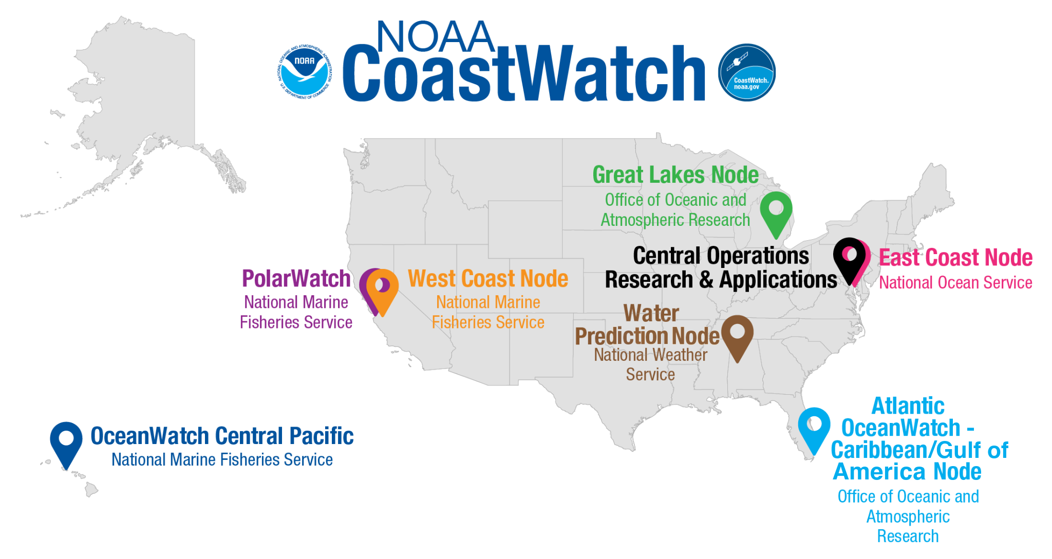
Organizational Structure
The NOAA CoastWatch Program is based in NOAA’s National Environmental Satellite and Data Information Service (NESDIS), in the Center for Applications and Research (STAR), Satellite Oceanography and Climatology Division (SOCD). CoastWatch is now organized as "4 pillars". The Central Operations team and the Applications & Research team are primarily based in College Park, MD. The Training & Outreach team and Regional Nodes are distributed geographically across the country and housed in various NOAA Line Offices. The CoastWatch Nodes currently include three in NOAA Fisheries (NMFS), two NOAA Research (OAR), one in the National Ocean Service (NOS) and, the newest Node in the National Weather Service (NWS).
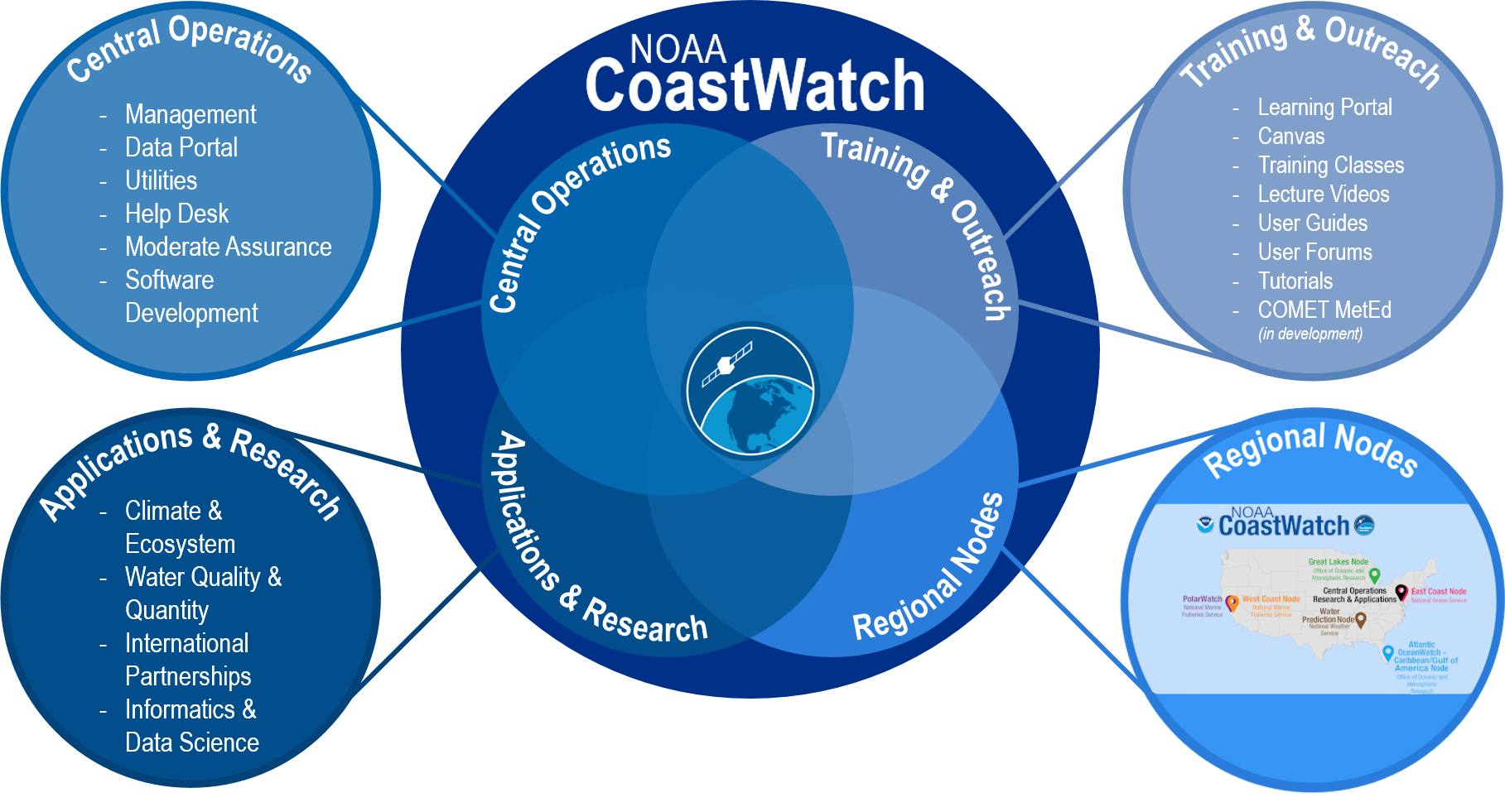
Together, these 4 pillars support the CoastWatch mission to help people use satellite data in their ocean, coastal and inland water applications. We do this by developing and processing value-added products for our NOAA operational users (such as time and space composites, etc.); customization for regional users; providing visualization and data download tools for one-stop shopping for available data, teaching free satellite data training courses and online tutorials; staffing a highly knowledgeable and responsive user helpdesk; and engaging and collaborating with stakeholders in the development of new products, tools and services in support of applications for decision-making. Innovation of new uses for remotely sensed data has the potential to give users tools and information from satellite data they didn’t even know they could want. Connections through the Regional Nodes means CoastWatch remains responsive to needs of the NOAA mission across all Line Offices.