Search Panel
Data Access Tools
A collection of tools, services, and information related to the searching, downloading, and/or visualization of CoastWatch Products
| Name | Description | Type |
|---|---|---|
| CoastWatch Data Portal |
The "all-in-one" NOAA CoastWatch / OceanWatch Data Portal for viewing products and accessing data files has been updated with new features and more data: Visualize, layer, geographically and temporally subset data products and download files for your selections Link to CoastWatch Data Portal |
Web Application |
CoastWatch Utilities
|
The CoastWatch Utilities read CoastWatch data files (NetCDF and HDF format) and contain graphical tools for interactive data viewing and command line tools for data processing. Link to Download CoastWatch Utilities Software |
Software Package |
Conversion Tools (Beta)
|
Conversion tools is a web application which includes multiple utilities that may help users access CoastWatch data and/or services. This includes Date & Time Converter, URL Builder L2 Search, and Sector Locator tools. Please note that web application is in testing and considering to be the beta version. Link to Conversion Tools Webpage |
Web Application |
| ERDDAP at NOAA CoastWatch |
The ERDDAP data server provides a simple, consistent way to subset and download gridded (Level 3 and above) environmental datasets in common file formats with options to make graphs and maps. At NOAA CoastWatch / OceanWatch / PolarWatch, all of the regional nodes and the CoastWatch Central hub now have ERDDAP servers in place as an option for data access. Link to ERDDAP at NOAA CoastWatch |
Remote Data Server , Web Application |
In-situ Ocean Color Optical Database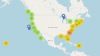
|
The data shared in this NOAA in situ Ocean Color Database are made freely available to the public and the scientific community with the intent that the wide dissemination of data lead to greater understanding, new insights and applications, and improved outcomes from decision-making and also in accordance with the NOAA Data and Publication Sharing Directive for NOAA Grants, Cooperative Agreements, and Contracts, V.3 (2016). The investigators sharing their data through this database rely on the ethics and integrity of the user to ensure that the institutions and investigators involved in producing these data receive fair credit for their work. Link to In-situ Ocean Color Optical Database |
In-situ Observations , Web Application |
| NOAA CoastWatch Near Real-time Search |
The Near Real Time Search tool gives the user the ability of selecting OceanWatch data products based on their region of interest, the products associated with that region, the individual sensor used to obtain this data, and a time period of interest. Products can be obtained either by category or by selecting criteria in the Search Criteria panel on the left. Link to NOAA CoastWatch Real-time Search |
Web Application |
NOAA ShipWatch
|
NOAA CoastWatch supports the NOAA Office of Marine and Aviation Operations through NOAA ShipWatch |
Web Application |
| RADS Utilities |
The Radar Altimeter Database System (RADS) was developed by the Delft Institute for Earth-Oriented Space Research, the NOAA Laboratory for Satellite Altimetry, and EUMETSAT. RADS provides a suite of tools or utilities that simplify the reading, editing and handling of data from multiple satellite radar altimeters. These tools abstract the user from having to work directly with the NetCDF datasets. Updates and corrections usually are performed to the data files, allowing the software tools to remain unchanged. RADS Utilities GitHub Repository |
Software Package |
| THREDDS Catalog at NOAA CoastWatch |
The THREDDS Data Server (TDS) is a web server that provides metadata and data access for scientific datasets, using OPeNDAP, OGC WMS and WCS, HTTP, and other remote data access protocols. The TDS is developed and supported by Unidata, a division of the University Corporation for Atmospheric Research (UCAR), and is sponsored by the National Science Foundation. Link to NOAA CoastWatch THREDDS catalog |
Remote Data Server |