| Date |
March 20, 2019
|
|---|---|
| Content Type |
User Story
|
|
|
| Data Applications |
Transportation & Safety
|
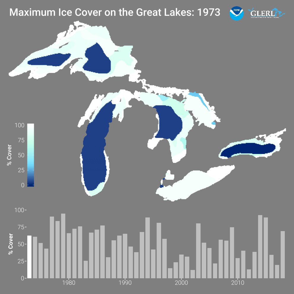
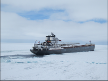
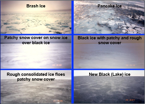
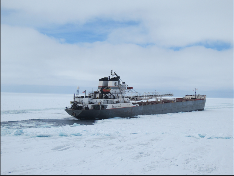
The Great Lakes are home to many port cities in the United States and Canada. Ice formation can be an obstacle for U.S. Coast Guard, commercial, and fishing boats. In order to understand ice formation and the types of ice in the Great Lakes, the NOAA Great Lakes Environmental Research Laboratory (GLERL) and the U.S. Coast Guard use Synthetic Aperture Radar (SAR) data from the NOAA CoastWatch Great Lakes Node to monitor six different types of ice, ice thickness, and ice cover. This risk assessment tool is known as the Ice Condition Index (ICECON).
The U.S. Coast Guard uses ICECON to identify areas that require ice breaking operations and ship transit assistance. These ice breaking operations allow government and commercial ships to travel through the Great Lakes unobstructed.
NOAA uses ICECON to provide valuable insight to Great Lakes climatology, water quality assessment, winter ice navigation, and algal blooms. More information on this product can be found on the NOAA CoastWatch Great Lakes Node website.