| Date |
September 23, 2021
|
|---|---|
| Content Type |
User Story
|
|
|
| Data Applications |
Climate & Weather
Ocean & Coastal Dynamics
|
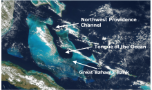
The Tongue of the Ocean is a deep water basin in the Bahamas that is surrounded to the east, west and south by a carbonate bank known as the Great Bahama Bank. The deep blue water of the Tongue is a stark contrast to the shallow turquoise waters of the surrounding Bank. This sheltered region is a popular foraging ground for cetateans including Cuvier's and Blainville's beaked whales.
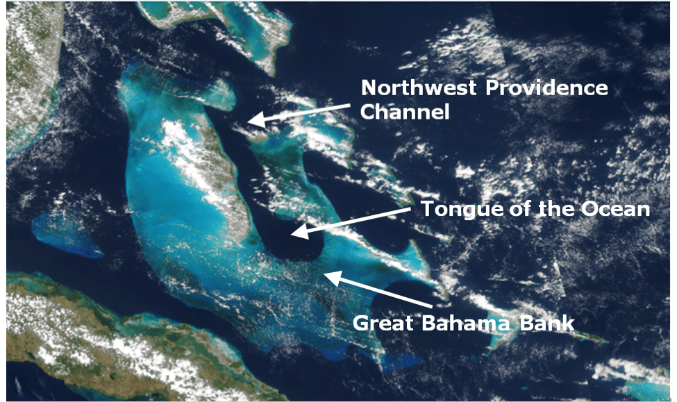
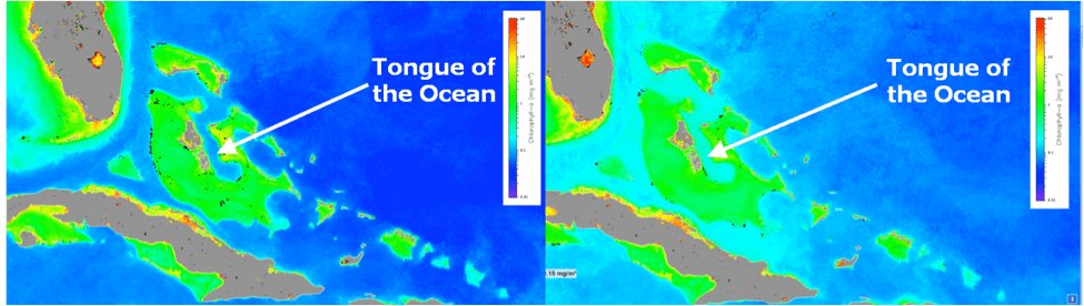
Water primarily enters the Tongue of the Ocean from the Northwest Providence Channel to the north though water from the Bank is known to intermittently mix into the Tongue's surface waters. In general, the concentration of chlorophyll in this area of the Bahamas are higher in winter months and lower in summer months.
References and Related Reading
- Hooper V, J.A., Baringer, M.O., St. Laurent, L.C., and Dewar, D.N. 2016. Dissipation processes in the Tongue of the Ocean. Journal of Geophysical - Oceans.
- Condal, A.R., Vega-Moro, A., Ardisson, P.L. 2013. Climatological, annual and seasonal variability in chlorophyll concentration in the Gulf of Mexico, western Caribbean, and Bahamas using NASA colour maps. International Journal of Remote Sensing: 34(5), 1591-1614.
- Shonting, D.H. 1970. On the distribution of temperature, salinity and oxygen in the Tongue of the Ocean, Bahamas. Bulletin of Marine Science: 20(1): 35-56.