| Date |
March 23, 2022
|
|---|---|
| Content Type |
User Story
|

|
|
| Data Applications |
Climate & Weather
Ecosystem Monitoring
Transportation & Safety
|
As anyone who has lived in the Great Lakes region can tell you, lake effect snow is no joke. As cold air rushes over the Great Lakes, clouds form that deposit intense snowfall isolated to the land downwind of the lake. And for the NWS Forecast Office in Grand Rapids, Michigan, predicting lake effect snow is an integral part of their daily mission for nearly half the calendar year. Fortunately, meteorologists have a tried-and-true method of determining the likelihood of these dangerous storms.
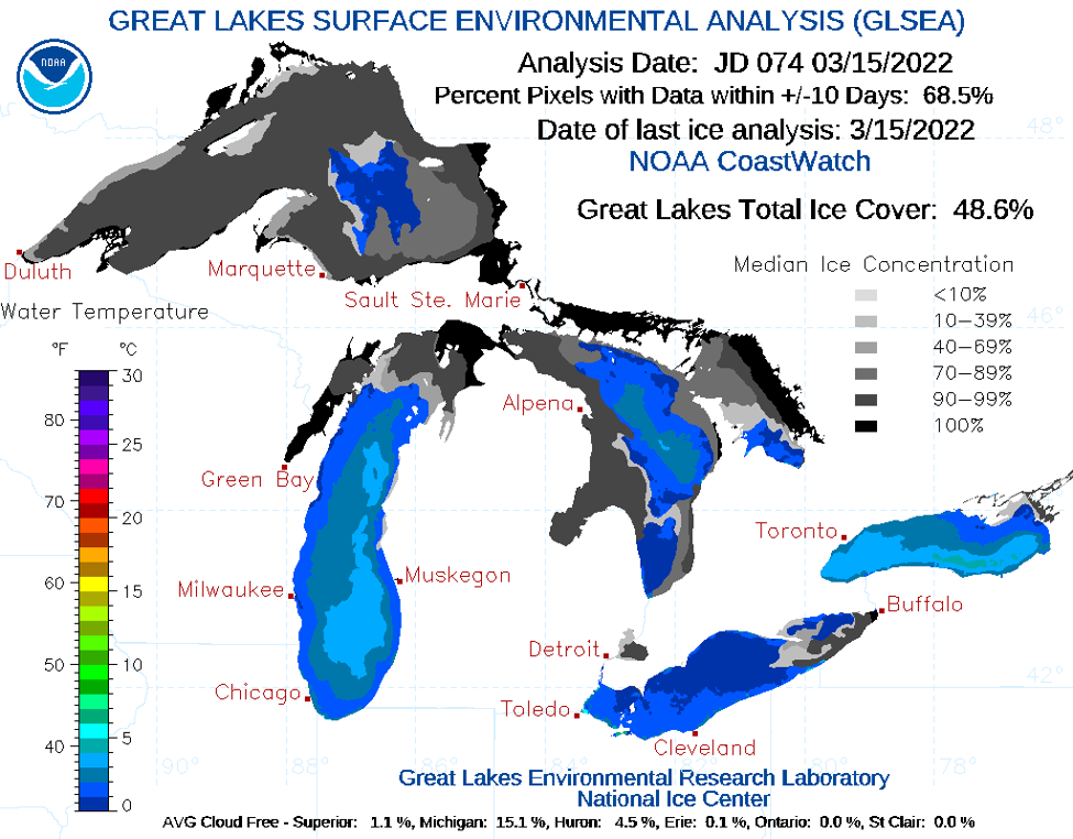
For lake effect snow storms to form, the air needs to be unstable and cold. Atmospheric instability is measured as a Delta T - or difference in temperature - between the lake surface and the air at 5000 feet. If Delta T is 13°C or greater, lake effect snow may occur. During the warmer months, the lake surface temperature (LST or classically termed sea surface temperature, SST) could be determined using buoys, but these buoys are out of commission in the winter. Instead, the team in Grand Rapids turns to CoastWatch for their critical satellite data.
“CoastWatch is always the source of the SST,” states Bob Dukesherer, Senior Forecaster and Marine Program Leader at the Grand Rapids Weather Forecast Office. “The lake surface temperatures are constantly changing, so we use the CoastWatch SST data as the gold standard in terms of what the lake temperature is.” The NOAA GLSEA LST/SST product can be retrieved from the CoastWatch Great Lakes node here https://coastwatch.glerl.noaa.gov/glsea/glsea.html.
Lake effect snow is not the only phenomenon that CoastWatch data is used to observe: “We also use SST data for freezing spray forecasts. Water temperatures need to be below +4°C or +5°C to allow freezing spray to occur…SST data from CoastWatch allows us to know whether or not we are cold enough for freezing spray to occur.” Freezing spray is particularly threatening to mariners and lakeside property, as the near-frozen lake water gets swept up by the cold wind and freezes upon contact with any surface with a temperature below 0°C. Additionally, Dukesherer and his colleagues use MODIS imagery to view the lake ice formations within 5 miles of the shore. “The best place to ascertain whether our nearshore waters are clogged with ice is MODIS imagery from CoastWatch. We have plenty of webcams, but they do not give us the view of the entire nearshore zone like the MODIS imagery does.”
For more on how CoastWatch serves the Great Lakes region, visit https://coastwatch.glerl.noaa.gov/. CoastWatch data can be retrieved from our data portal at https://coastwatch.noaa.gov/cw_html/cwViewer.html.