| Date |
May 26, 2022
|
|---|---|
| Content Type |
User Story
|
|
|
|
| Data Applications |
Climate & Weather
Ecosystem Monitoring
Ocean & Coastal Dynamics
Transportation & Safety
Water Quality
|
Dr. Sherry Palacios is an Assistant Professor of Marine Science at California State University, Monterey Bay. Her undergraduate courses include Introduction to Oceanography for first- and second-year students, and Biological & Physical Oceanography for third- and fourth-year students. Both courses include lectures and assignments that feature CoastWatch tools and data products. In one lab, students create a map and time series of chlorophyll concentrations using the CoastWatch Data Portal. Another remote sensing lab introduces them to ERDDAP and griddap maintained by the West Coast Regional Node. Materials from the CoastWatch Satellite Training Course are provided to supplement the in-class instruction.
Dr. Palacios’ introductory course concludes with a CURE, or Course-based Undergraduate Research Experience. CUREs can be time-consuming, but offer critical “hook” moments to engage students in real-world science. As the students explore their research topic, Dr. Palacios advises them with a light hand - providing guidance without dictating their projects. One suggestion she does stress to all students is to use the CoastWatch West Coast Regional Node ERDDAP server to find their data.
The students often impress their instructor with scientific insight, and this semester’s projects were no exception. Below are some of the research questions studied by the young oceanographers:
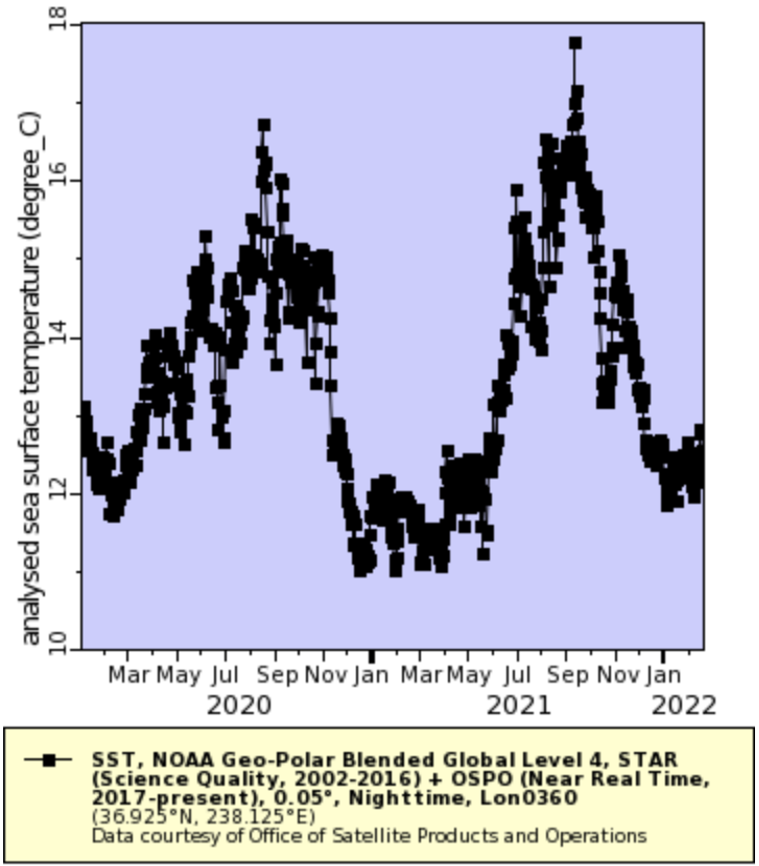
“Are there differences between temperature changes at different latitudes across the California coast?”
“How have the recent CA Wildfires affected the intensity of harmful algal blooms around the California coast?”
“Is there a difference in productivity between El Nino and La Nina events in the Monterey Bay?”
“Are there correlations between extreme drought conditions and fluctuations in chlorophyll concentration in the San Francisco Bay?”
“Do the shipping lanes of Los Angeles and Long Beach affect chlorophyll concentration and water quality?”
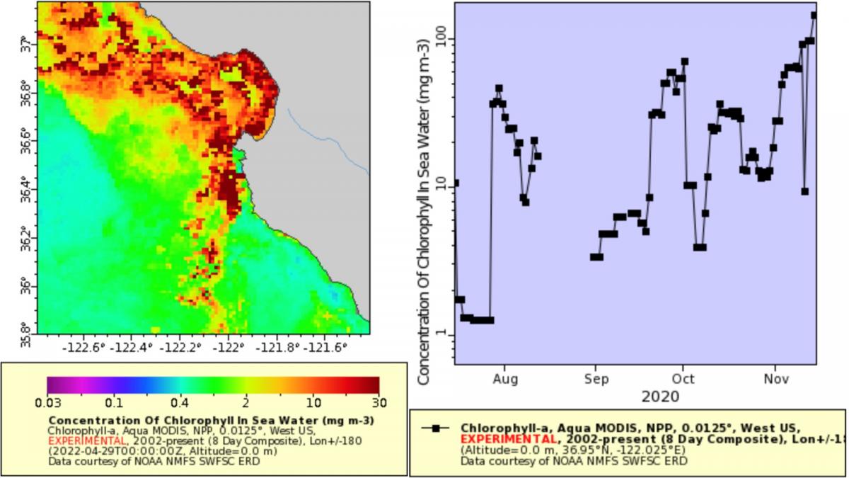
From one research project: "This data collected represents the chlorophyll-a concentrations two weeks before the CZU Lightning Complex Fire, through the fire period, and 2 months after. There is a gap in data during the fire period, but seems to gradually increase in the concentrations." - Samarth J., Taylor G., Kalina B.
While many students were able to sufficiently answer their inquiries, some overextended their constraints:
“How does shark productivity in the eastern boundary current of Monterey Bay compare to the western boundary current in the Gulf of Mexico during Covid (2020-2022) and what might have caused these contrasts?”
“How will recurring bleaching events affect the long-term recovery of different Caribbean coral species?”
The majority of students reported coming away from the course with a greater understanding of remote sensing and a better idea of how to conduct research.
Dr. Palacios intends to increase her use of CoastWatch tools and data in upcoming semesters, as our partnership strengthens