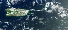
On July 25, 2022, a federal emergency was declared in response to unprecedented amounts of Sargassum plaguing the Caribbean. The island of St. Croix is in particularly dire straits as the inundation has caused a water shortage. From Puerto Rico to Barbados, the toxic seaweed has not subsided since May.
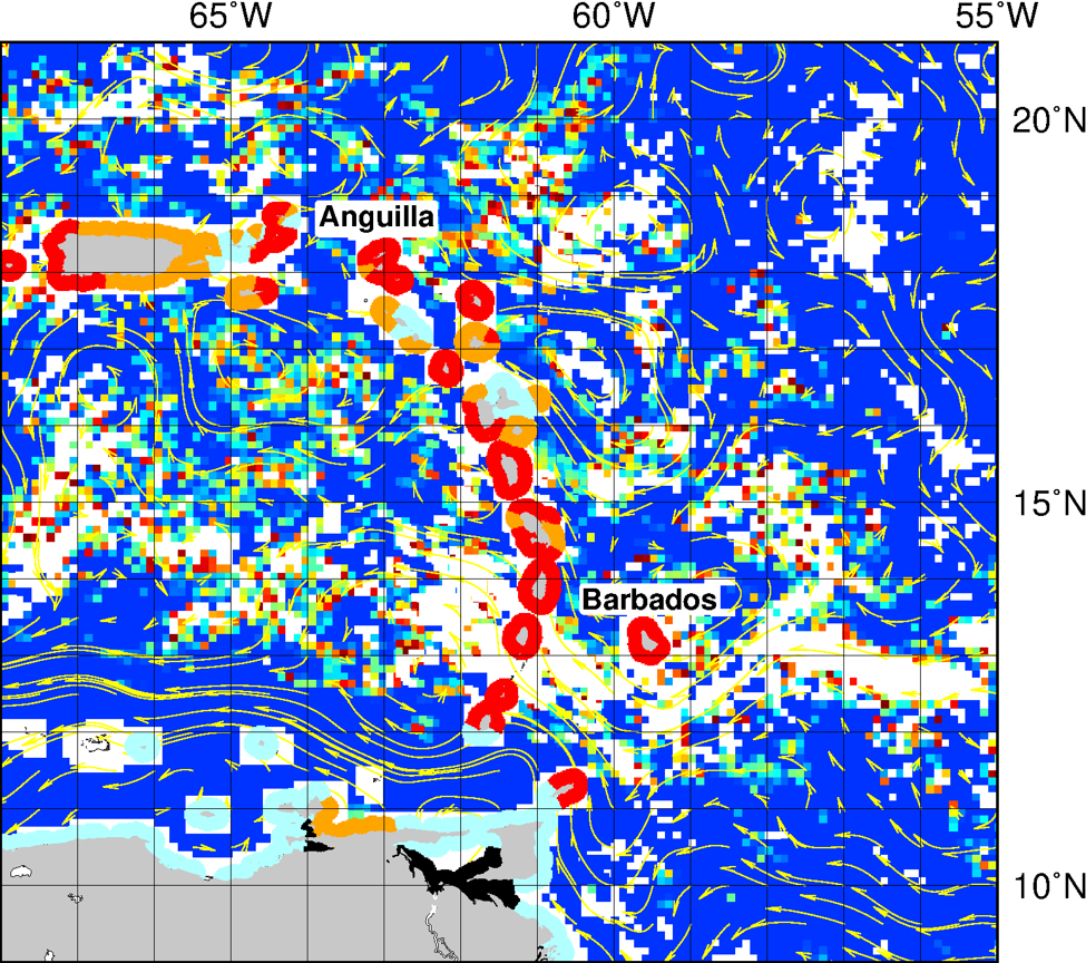
Sargassum is a macroalgae that appears brown or gold, and amasses in rafts that float upon the ocean surface. These aggregations of seaweed can grow to be several miles long, and traverse entire oceans. Researchers who frequently partner with OceanWatch produced a study in 2019 describing The Great Atlantic Sargassum Belt - a bloom spanning about 5500 miles from West Africa to the Gulf of Mexico that was first observed in 2011 - using satellite imagery. The increase in the size and range of Sargassum blooms is attributed to climate change(link is external), as pollutants and warming waters have fueled unmitigated growth over the past decade.
As Sargassum decomposes upon the shore, it releases gasses such as hydrogen sulfide that are not only unpleasantly aromatic, but potentially dangerous to breathe. The odorous clumps of seaweed negatively affect boating, fishing, and tourism, as well as natural phenomena such as sea turtle nesting(link is external).
But in moderation, Sargassum is an environmental asset. The algae absorbs toxins and carbon dioxide; it is a vital member of the carbon cycle. Its branches provide a habitat that supports a variety of animals, some of which are entirely dependent on it for their livelihood. These ecosystems are federally protected, further complicating the need to protect the human residents in the Caribbean.
FEMA has been dispatched to the Virgin Islands since July 15 to aid in the ongoing economic and health crises. With guidance on how to safely collect and remove the seaweed remaining unclear, monitoring Sargassum inundation is a top priority. CoastWatch/OceanWatch is uniquely poised to provide this service. The Caribbean, Gulf of Mexico, and Atlantic OceanWatch Node - housed by the Office of Oceanic and Atmospheric Research Atlantic Oceanic and Meteorological Laboratory (OAR/AOML) and managed by Dr. Gustavo Goni and Dr. Joaquin Trinanes - produces the Sargassum Inundation Report (SIR) in collaboration with the University of South Florida (USF). Dr. Trinanes also developed and maintains the OceanViewer tool that maps satellite data, including Sargassum concentration.
Dr. Goni and Dr. Trinanes are participating in the USVI/Sargassum Emergency FEMA Workshop in St. Croix. Their efforts, accompanied by their data, are actively contributing to the greater understanding of the situation. With greater understanding comes better responses, and better preparation for the next season.