| Date |
September 23, 2021
|
|---|---|
| Content Type |
User Story
|
| Author(s) | |
|
|
| Data Applications |
Climate & Weather
Ocean & Coastal Dynamics
Transportation & Safety
|
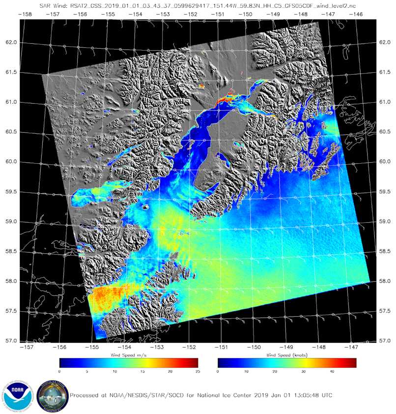
Synthetic Aperture Radar (SAR) is an active radar satellite instrument that transmits microwave pulses that bounce off the Earth’s surface. The radar signals are then processed into imagery that can be used to derive several geographic and non-geographic features including: wind speeds, oil spills, sea ice and ship detection. Unlike optical imagery, SAR can be used night and day and is not limited by clouds, fog or precipitation. SAR imagery resolution ranges between sub-meter to 100m depending on the satellite’s orbit and angle.
In SAR imagery, smooth ocean surface areas appear as dark spots and rough ocean surface areas appear as bright spots. NOAA’s SAR team inputs this information about sea surface roughness into models to produce SAR-derived wind speed products and SAR sea ice imagery.
One of the largest users of NOAA SAR wind data is the Alaska Weather Service. The Alaska Weather Service uses SAR images to identify locations of “orographic” or gap winds (strong offshore wind flows that occur between mountain gaps) for maritime safety and navigation. Gap winds can influence ocean circulation, ocean currents, and chlorophyll-a distributions; all of which can have impacts on the ecology of the Gulf of Alaska.
NOAA’s Sea Ice Research Group use SAR imagery to identify sea ice type for research purposes and the United States National Ice Center (NIC) who use SAR products for global ice analysis and forecasts. Recently, SAR has been used to identify ice recession in the arctic.

References and Related Readings
- Ladd, C., & Cheng, W. (2016). Gap winds and their effects on regional oceanography Part I: Cross Sound, Alaska. Deep Sea Research Part II: Topical Studies in Oceanography,132, 41-53.
- Monaldo, F., Jackson, C., & Pichel, W. (2013). Seasat to Radarsat-2: Research to Operations. Oceanography,26(2).
- Pichel, W. G., & Clemente-Colón, P. (2000). NOAA CoastWatch SAR Applications and Demonstration. JOHNS HOPKINS APL TECHNICAL DIGEST, 21(1), 49-57.
- Zakhvatkina, N., Smirnov, V., & Bychkova, I. (2019). Satellite SAR Data-based Sea Ice Classification: An Overview. Geosciences, 9(4), 152.