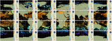
NOAA CoastWatch co-gridded VIIRS SST products are Level 3 daily composites in compatible format and projection with other CoastWatch Level 3 sector and global products (such as CoastWatch sector VIIRS ocean color). Twenty four CoastWatch sector files mapped to equatorial projection that cover the globe (see Description tab for sector definitions) two polar stereographic sectors in 750 m nominal, native resolution and a global, 4 km resolution, single file mapped product is also available. These CoastWatch Level 3 products are generated from ACSPO L2P SST as input.
 An official website of the United States government

![Example of MESI product [zoomed from global] centered on the Atlantic Ocean.](../sites/default/files/styles/medium/public/2026-03/MESI_v1_multi_global_daily_s20260221_e20260221e8f1.png?itok=9XXZ6a1Z)