Terra

Description

Earth Observation System - Terra

Platform Type
Low Earth Orbit Satellite (LEO)
Instruments
Organizations
NASA
Orbital Altitude
705 km
Equatorial Crossing Times
10:30 desc

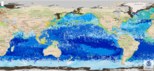
ACSPO Global SST from MODIS

Product Families
Sea Surface Temperature
Summary

The ACSPO MODIS SST data are produced from Terra and Aqua satellites using the NOAA Advanced Clear-Sky Processor for Ocean (ACSPO) enterprise system (Ignatov et al., 2016). Complete archive of ACSPO MODIS SST data is available for both the Terra (24 Feb 2000 - present) and Aqua (4 July 2002 - present) missions in 0.02° L3C (level 3 collated) format. New data is added in delayed mode (DM) with a 2-month latency.  The last orbital maintenance maneuvers for Aqua and Terra were performed on 27 Feb 2020 (Terra) and 18 Mar 2021 (Aqua) and their orbit has been drifting ever since. We do not recommend usage of ACSPO MODIS SST dated a year or later after each satellites' last orbital maintenance maneuver. For more recent SST data from low earth orbit satellites, we recommend the ACSPO VIIRS and AVHRR FRAC datasets.

Seascape Pelagic Habitat Classification

Product Families
Seascape Classification
Summary

MBON Seascapes identifies spatially explicit water masses with particular biogeochemical features using a model and satellite-derived measurements.  The seascape product is generated as monthly and 8-day composites at 5 km spatial resolution

ACSPO Global 0.02º Gridded Super-collated SST and Thermal Fronts from Low-Earth-Orbiting Platforms (L3S-LEO)

Product Families
Sea Surface Temperature
Summary

NOAA Advanced Clear-Sky Processor for Ocean (ACSPO) L3S-LEO SST is a family of multisensor gridded ("L3") 0.02º resolution super-collated ("S") products. The L3S-LEO family is organized into three lines: PM, AM and Daily. The AM and PM lines correspond to 9:30am/pm and 1:30am/pm equator crossing times, respectively. The Daily line combines PM and AM (day and night) SSTs into a single daily L3S SST that is normalized to 1:30am viewing conditions.