Polar Sea Ice

Both thermal and microwave sensors can be used to estimate sea ice.  The thermal method has higher spatial resolution but is impacted by clouds (e.g., VIIRS).  The microwave method is lower spatial resolution but not impacted by clouds (e.g. AMSR-2).

VIIRS - Sea Ice Concentration, Ice Thickness, Ice Surface Temperature

Product Families
Polar Sea Ice
Summary

VIIRS Sea Ice Concentration, Sea Ice Thickness and Ice Surface Temperature NOAA CoastWatch/OceanWatch/PolarWatch Level 3, Daily and daily 4-day rolling merged, mapped composites in both polar stereographic projections and CW sector mapped for Northern and Southern hemispheres.

AMSR2 - Sea Ice Concentration

Product Families
Polar Sea Ice
Summary

NOAA CoastWatch / OceanWatch / PolarWatch Sea Ice Concentration, Level 3, daily and daily 4-day rolling merge, polar stereographic mapped composites -  AMSR-2

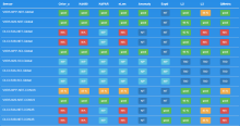
CoastWatch Data Quality & Availability Dashboard

Monitor Type
Data Assurance
Quality Assurance
Description

This Data Availability Dashboard gives a concise report of product availability and a quick look at a bulk time series to monitor for product stability