The AHI SST data are produced from Himawari-9 (Himawari-8 before 2022-Dec-13) geostationary satellite using the NOAA Advanced Clear-Sky Processor for Ocean (ACSPO) v2.90 enterprise system,(ACSPO v2.70 was used for Himawari-8). Currently, only near-real time (NRT) data are produced at STAR, with a 2-6 hour latency (typically closer to 2 hours). The data are available in NetCDF4 format, compliant with the GHRSST Data Specifications v2 (GDS2). The data for Himawari-8 was archived with PO.DAAC with start date 2019-Oct-16 and end date 2022-Dec-13. The full mission of the Himawari-9 has been archiving in PO.DAAC. The data for Himawari-9 is also available at this Coast Watch page as a 2week rotated buffer. The reanalysis of the full mission of the Himawari-8 is available at this Coast Watch page. There is a plan to reprocess the AHI data, for the full Himawari-9 missions.
Data Access
Product Overview
The AHI SST data are produced from Himawari-9 (Himawari-8 before 2022-Dec-13 ) geostationary satellite using the NOAA Advanced Clear-Sky Processor for Ocean (ACSPO) v2.90 enterprise system (ACSPO v2.70 was used for Himawari-8). Currently, only near-real time (NRT) data are produced at STAR, with a 2-6 hour latency (typically closer to 2 hours). The data are available in NetCDF4 format, compliant with the GHRSST Data Specifications v2 (GDS2). The data for Himawari-8 was archived with PO.DAAC with start date 2019-Oct-16 and end date 2022-Dec-13. The full mission of the Himawari-9 has been archiving in PO.DAAC. The data is also available at this Coast Watch page as a 2week rotated buffer. The reanalysis of the full mission of the Himawari-8 with ACSPO v2.90 is available at this Coast Watch page. There is a plan to reprocess the AHI data, for the full Himawari-9 missions.
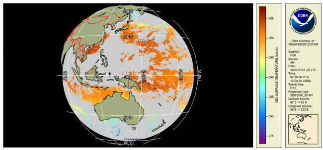
The data are reported hourly, in AHI Full Disk (FD), for view zenith angle not exceeding 68°, both in swath projection (L2P) and as a 0.02° gridded L3C. There are 24 FDs per day, with a total data volume of 6.3GB/day for L2P and 0.6GB/day for L3C, respectively.
In each valid water pixel (defined as ocean, sea, lake or river, up to 5km inland; note that in "invalid" pixels, defined as those with >5km inland, fill values are reported), the following layers are reported in both L2P and L3C: SSTs derived using multi-channel SST (MCSST; night) and Non-Linear SST (NLSST; day) algorithms (Petrenko et al., 2014); ACSPO clear-sky mask (ACSM; provided in each pixel as part of l2p_flags; Petrenko et al., 2010); SSES bias and standard deviation (Petrenko et al., 2016); NCEP wind speed; and ACSPO SST minus reference (Canadian Met Centre L4 SST). For L2P, brightness temperatures (BTs) in 3.9, 8.6, 10, 11, and 12 µm bands are also reported, for those users interested in direct radiance assimilation (e.g., NOAA NCEP, NASA GMAO).
Only ACSM "confidently clear" pixels (equivalent to GDS2 "quality level"=5; also reported for each pixel) should be used. The ACSM also provides day/night, land, ice, twilight, and glint flags. Note that users of ACSPO data have the flexibility to ignore the ACSM, derive their own clear-sky mask, and use BTs and SSTs in those pixels. They may also ignore ACSPO SST, and derive their own SSTs from the original BTs.
Both L2P and L3C SSTs are monitored and validated against in situ data (Xu and Ignatov, 2014) in SQUAM (Dash et al., 2010) and ARMS (Ding et al., 2017) systems, and BTs are monitored in MICROS (Liang and Ignatov, 2011).
Product Details
| Short Names |
AHI_H08-STAR-L2P-v2.70
AHI_H08-STAR-L3C-v2.70
H09-AHI-L2P-ACSPO-v2.90
H09-AHI-L3C-ACSPO-v2.90
|
|---|---|
| Temporal Start Date |
October 16, 2019
|
| Product DOI | |
| Product Families |
Sea Surface Temperature
|
| Measurements |
Sea Surface Temperature - Geostationary
|
| Processing Levels |
Level 2
Level 3
|
| Latency Groups |
0 Hours <= 24 Hours (NRT)
|
| Latency Details |
2-6 hours (typically closer to 2 hours) |
| Spatial Resolution Groups |
2km+
|
| Spatial Resolution Details |
L2P: From 2km@Nadir(link sends e-mail) to ~12km @VZA=68° |
| Data Providers |
JMA
NOAA
NESDIS
STAR
|
Spatial Coverage
East Asia & Western Pacific
| Description |
80E-160W |
|---|
Processing Algorithms
ACSPO
| Description |
Advanced Clear Sky Processor for Ocean (ACSPO) is the NOAA Enterprise SST system |
|---|
Platforms
Documentation
Algorithms:
- Petrenko, B., A. Ignatov, Y. Kihai, M. Pennybacker, 2019: Optimization of sensitivity of GOES-16 ABI sea surface temperature by matching satellite observations with L4 analysis. Remote Sens, 11, 206, doi: 10.3390/rs11020206, https://www.mdpi.com/2072-4292/11/2/206/htm
- Petrenko, B., A. Ignatov, M. Kramar, Y. Kihai, 2016: Exploring new bands in multichannel regression SST algorithms for the next generation infrared sensors at NOAA. Proc. SPIE 9827, Ocean Sensing and Monitoring VIII, 98270N (30 May 2016); doi:10.1117/12.2229578, ftp://ftp.star.nesdis.noaa.gov/pub/sod/osb/aignatov/SPIE/2016/Papers/PetrenkoEtAl_Improved_ACSPO_Algorithms_98270N.pdf
- Kramar, M., A. Ignatov, B. Petrenko, Y. Kihai, P. Dash, 2016: Near Real Time SST retrievals from Himawari-8 at NOAA using ACSPO system. Proc. SPIE 9827, Ocean Sensing and Monitoring VIII, 98270L (30 May 2016); doi:10.1117/12.2229771, ftp://ftp.star.nesdis.noaa.gov/pub/sod/osb/aignatov/SPIE/2016/Papers/KramarEtAl_ACSPO_AHI_98270L.pdf
- Ignatov, A., I. Gladkova, Y. Ding, F. Shahriar, Y. Kihai, X. Zhou, JPSS VIIRS level 3 uncollated SST Product at NOAA”. J. Appl. Remote Sens., 11(3), 032405, doi:10.1117/1.JRS.11.032405 (2017), ftp://ftp.star.nesdis.noaa.gov/pub/sod/osb/aignatov/Irina/L3U/JARS_11_3_032405.pdf
Monitoring:
- SQUAM (https://www.star.nesdis.noaa.gov/sod/sst/squam/): Dash, P., A. Ignatov, Y. Kihai & J. Sapper, 2010: The SST Quality Monitor (SQUAM). JTech, 27, 1899-1917,doi:10.1175/2010JTECHO756.1
- iQUAM (https://www.star.nesdis.noaa.gov/sod/sst/iquam/): Xu, F. & A. Ignatov, 2014: In situ SST Quality Monitor (iQuam). JTech, 31, 164-180, doi:10.1175/JTECH-D-13-00121.1
- ARMS (https://www.star.nesdis.noaa.gov/sod/sst/arms/): Ding, Y., A. Ignatov, K. He, I. Gladkova, 2018: ACSPO Regional Monitor for SST (ARMS). GHRSTT XIX: Science Team Meeting, June 2018, Darmstadt, Germany, ftp://ftp.star.nesdis.noaa.gov/pub/sod/osb/aignatov/GHRSST/G19/Presentations/G19_Oral_ARMS_Ignatov_v02.pptx
- MICROS (https://www.star.nesdis.noaa.gov/sod/sst/micros/):Liang, X. & A. Ignatov, 2011: Monitoring of IR Clear-sky Radiances over Oceans for SST (MICROS). JTech, 28, 1228-1242, doi:10.1175/JTECH-D-10-05023.1
Citation
The ACSPO AHI SST data are provided by NOAA STAR. We strongly recommend contacting NOAA SST team led by A. Ignatov before the data are used for any publication or presentation.