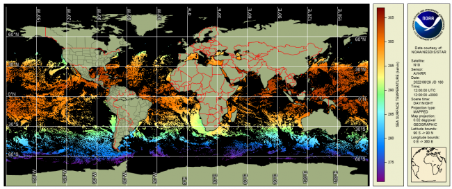
AVHRR GAC Reanalysis 2 (RAN2) dataset is an improved and extended version of AVHRR GAC RAN1 (Ignatov et al., 2016). RAN2 is produced from 5 AVHRR/2s (onboard N07/09/11/12/14) and 5 AVHRR/3s (N15/16/17/18/19) using the NOAA Advanced Clear-Sky Processor for Ocean (ACSPO) enterprise system v2.81. At the time of release, it covers from 1 Sep 1981 to 31 Dec 2021 and will be periodically extended as new L1b data from N15/18/19 arrive. Out of ten satellites, seven (N07/09/11/14/16/18/19) were initially launched into afternoon orbits (1:30pm/am), two (N12/15) into early-morning orbits (7:30pm/am), and one (N17) into mid-morning orbit (10am/pm). All NOAA orbits are not controlled and evolve in time. The RAN2 dataset is documented in (Petrenko et al. 2020 and 2021; Pryamitsyn et al. 2020)
Data Access
Product Overview
AVHRR FRAC onboard three Metop-First Generation (FG) satellites have been processed separately. AVHRR FRAC RAN1 dataset is available at ACSPO Global SST from AVHRR FRAC.
The data are reported in GHRSST Data Specifications v2 (GDS2) format, in three projections: swath (L2P), 0.02° gridded L3U (U=uncollated) and 0.02° gridded L3C (C=collated). L2P and L3U products are aggregated into 10min granules, 144 per day, with a total daily data volumes of 0.27GB/L2P and 0.32GB/L3U. L3C product contains two collated files per day, daily volume of 0.3GB/day, : one file for the daytime SST and one for the nighttime SST. ACSPO retrievals are made in full AVHRR swath (~2,800 km). For data assimilation applications (such as production of L4 analyses, especially those blending satellite and in situ data), subtraction of the Sensor-Specific Error Statistics (SSES; Petrenko et al., 2016) biases reported in ACSPO files, is recommended.
In each valid water pixel (defined as ocean, sea, lake or river, up to 5km inland), the following layers are reported in both L2P and L3U: SSTs derived using Non-Linear SST (NLSST) algorithms (Petrenko et al., 2020); ACSPO clear-sky mask (ACSM; provided in each pixel as part of l2p_flags; Petrenko et al., 2010); SSES bias and standard deviation (Petrenko et al., 2016); MERRA-2 wind speed; and ACSPO SST minus reference SST (ESA CCI L4 SST from 1 Sep 1981 - 31 Aug 1991; switched to CMC L4 SST from 1 Sep 1991 to present time). In "invalid" pixels (defined as those with >5km inland), fill values are reported.
Only ACSM "confidently clear" pixels (equivalent to GDS2 "quality level"=5; QLs are also reported for each pixel) should be used. The ACSM also provides day/night, land, ice, twilight, and glint flags.
All L2P, L3U and L3C SSTs are monitored and validated against in situ data iQuam (Xu and Ignatov, 2014) in SQUAM (Dash et al., 2010), and BTs are monitored in MICROS (Liang and Ignatov, 2011). The AVHRR sensors calibration and characterization, and orbital stability of NOAA satellites, are monitored in the NOAA 3S system (He et al., 2016)
Product Details
| Short Names |
L2P: ACSPO AVHRR GAC RAN2 L2P
L3U: ACSPO AVHRR GAC RAN2 L3U
|
|---|---|
| Temporal Start Date |
September 1, 1981
|
| Product Families |
Sea Surface Temperature
|
| Measurements |
Sea Surface Temperature - Polar-orbiting
|
| Processing Levels |
Level 2
Level 3
|
| Latency Groups |
0 Hours <= 24 Hours (NRT)
|
| Latency Details |
~2 to 6 hours latency |
| Spatial Resolution Groups |
2km+
|
| Spatial Resolution Details |
L2P: 4km @Nadir; ~25km @swath edge |
| Data Providers |
NOAA
NESDIS
STAR
|
Spatial Coverage
Global
| Description |
180W - 180E |
|---|
Processing Algorithms
ACSPO
| Description |
Advanced Clear Sky Processor for Ocean (ACSPO) is the NOAA Enterprise SST system |
|---|
Platforms
Documentation
Algorithms and Evaluation
Petrenko, B., A. Ignatov, Y. Kihai, and A. Heidinger, 2010: Clear-Sky Mask for ACSPO. JTech, 27, 1609-1623, doi:10.1175/2010JTECHA1413.1
Petrenko, B., A. Ignatov, Y. Kihai, J. Stroup, P. Dash, 2014: Evaluation and Selection of SST Regression Algorithms for JPSS VIIRS. JGR, 119, 4580-4599, doi:10.1002/2013JD020637
Petrenko, B., A. Ignatov, Y. Kihai, P. Dash, 2016: Sensor-Specific Error Statistics for SST in the Advanced Clear-Sky Processor for Oceans. JTech, 33, 345-359, doi:10.1175/JTECH-D-15-0166.1
Ignatov, A., X. Zhou, B. Petrenko, X. Liang, Y. Kihai, P. Dash, J. Stroup, J. Sapper, & P. DiGiacomo, 2016: AVHRR GAC SST Reanalysis Version 1 (RAN1). Remote Sens., 8(4), 315,doi: 10.3390/rs6040315
Petrenko B., V. Pryamitsyn, , A. Ignatov, & Y. Kihai, 2020: SST and cloud mask algorithms in reprocessing 1981-2002 NOAA AVHRR data for SST with the Advanced Clear-Sky Processor for Oceans (ACSPO). SPIE Defense + Commercial Sensing, 11420, SI, www.spiedigitallibrary.org,
Pryamitsyn, V., A. Ignatov, B. Petrenko, O. Jonasson & Y. Kihai, 2020: Evaluation of the initial NOAA AVHRR GAC SST reanalysis version 2 (RAN2 B01). SPIE Defense + Commercial Sensing, 11420I, https://doi.org/10.1117/12.2558660,
Petrenko, B.; Pryamitsyn, V.; Ignatov, A. 2021;Filtering cold outliers in SSTs retrieved from early AVHRRs for the second AVHRR GAC reanalysis. SPIE Defense + Commercial Sensing , 11752, https://doi.org/10.1117/12.2585908
Petrenko B, Pryamitsyn V, Ignatov A, Jonasson O, Kihai Y. 2022; AVHRR GAC Sea Surface Temperature Reanalysis Version 2, Remote Sens. 14(13):3165. https://doi.org/10.3390/rs14133165
Monitoring
Dash, P., A. Ignatov, Y. Kihai & J. Sapper, 2010: The SST Quality Monitor (SQUAM). JTech, 27, 1899-1917, doi:10.1175/2010JTECHO756.1, www.star.nesdis.noaa.gov/sod/sst/squam/
Ding, Y., A. Ignatov, I. Gladkova, M. Crosberg, and C. Chu, 2017: ACSPO Regional Monitor for SST (ARMS). BoM - NOAA SST Workshop, 18-21 April 2017, Melbourne, Australia (presentation), www.star.nesdis.noaa.gov/sod/sst/arms/
Liang, X. & A. Ignatov, 2011: Monitoring of IR Clear-sky Radiances over Oceans for SST (MICROS). JTech, 28, 1228-1242, doi:10.1175/JTECH-D-10-05023.1, www.star.nesdis.noaa.gov/sod/sst/micros/
Xu, F. & A. Ignatov, 2014: In situ SST Quality Monitor (iQuam). JTech, 31, 164-180, doi:10.1175/JTECH-D-13-00121.1, www.star.nesdis.noaa.gov/sod/sst/iquam/ He, K.; Ignatov, A.; Kihai, Y.; Cao, C.Y.; Stroup, J. 2016; Analyzing Avhrr Thermal Calibration Using Sensor Stability for Sst (3s) System. 2016 Ieee International Geoscience and Remote Sensing Symposium (Igarss) , 1950-1953, https://doi.org/10.1109/Igarss.2016.7729502
Citation
Petrenko B, Pryamitsyn V, Ignatov A, Jonasson O, Kihai Y. 2022; AVHRR GAC Sea Surface Temperature Reanalysis Version 2, Remote Sens. 14(13):3165. https://doi.org/10.3390/rs14133165 (link is external)
The ACSPO AVHRR GAC RAN data are provided by NOAA STAR. We strongly recommend contacting NOAA SST team led by A. Ignatov before the data are used for any publication or presentation.