The NOAA Laboratory for Satellite Altimetry's (LSA) sea surface height team produces 0.25-degree longitude/latitude Level-3 significant wave height, wind speed, and sea level anomaly (SLA) daily datasets by applying optimal interpolation to along-track satellite observations over the global ocean from a constellation of radar altimeter missions. Theses grids are produced with near-real time (3-5 hour latency) data.
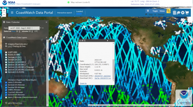
Data Access
Product Overview
Product Details
| Temporal Start Date |
September 1, 2016
|
|---|---|
| Temporal Coverage |
Along-track data products available 09-2016 to present for Jason-3; Sentinel-3A; CryoSat-2; SARAL. Jason-2 ended 1 Oct 2019. |
| Product Families |
Sea Surface Height
Sea Surface Winds
|
| Measurements |
Along-track Significant Wave Height
Sea Surface Height Anomalies
Sea Surface Wind Speed
|
| Processing Levels |
Level 2
|
| Latency Groups |
0 Hours <= 24 Hours (NRT)
|
| Latency Details |
~ 1 day |
| Spatial Resolution Groups |
2km+
|
| Spatial Resolution Details |
0.25° |
| Data Providers |
NOAA
NESDIS
STAR
LSA
|
Spatial Coverage
Global
| Description |
180W - 180E |
|---|
Processing Algorithms
RADS
| Description |
Radar Altimeter Database System (RADS) |
|---|---|
| Algorithm Details |
The Radar Altimeter Database System (RADS) is employed is employed at NESDIS/STAR as a enterprise multi-mission algorithm providing consistent sea level anomaly, waves, and ocean surface wind speed products. RADS is a joint effort of the NOAA Laboratory for Satellite Altimetry (LSA), EUMETSAT, and Department of Earth Observation and Space Systems (DEOS) at the Delft University of Technology to establish a harmonized, validated, and cross-calibrated sea level data base from satellite altimeter data. RADS was designed primarily as a database tool for expert altimetry users but through NOAA CoastWatch and LSA training materials, may have appeal at both expert and entry levels: advisory councils, water management authorities, teachers, and students. RADS homogenizes data from multiple missions which in turn are used to generate Level-2P products for operational users, including data assimilation at NOAA and the US Navy (e.g. the Global Real-Time Ocean Forecast System (Global RTOFS) and the West Coast Operational Forecast System) and Level-2P and Level-3 products distributed through NOAA CoastWatch (Sea Level Anomaly and along-track altimetry). It is also used as calibration/validation platform. The database is a collection of continually updated NetCDF datasets. Geophysical Data Records and associated corrections are processed and stored in homogenized NetCDF pass files. Near real-time processing is done two times per day at NOAA for the following missions: Jason-3, Sentinel-3A, Sentinel-3B, AltiKa/SARAL, and CryoSat-2. Reprocessing is done jointly with EUMETSAT. These files can then be used to generate products using the RADS data utilities. Variables used within RADS include (not all inclusive):
|
| Documentation |
Scharroo, R., E. W. Leuliette, J. L. Lillibridge, D. Byrne, M. C. Naeije, and G. T. Mitchum, RADS: Consistent multi-mission products, in Proc. of the Symposium on 20 Years of Progress in Radar Altimetry, Venice, 20-28 September 2012, European Space Agency Special Publication, ESA SP-710, p. 4 pp., 2013. RADS Data Manual The data manual describes the details of variables used in the RADS database. |
Platforms
JASON-2
| Description |
Reference altimetry mission |
|---|---|
| Platform Type |
Low Earth Orbit Satellite (LEO)
|
| Instruments | |
| Organizations |
CNES
EUMETSAT
NASA
NOAA
|
| Orbital Altitude |
1309.5 km
|
| Orbital Inclination |
66°
|
| Equatorial Crossing Times |
Variable
|
JASON-3
| Description |
Altimetry reference mission |
|---|---|
| Platform Type |
Low Earth Orbit Satellite (LEO)
|
| Instruments | |
| Organizations |
CNES
EUMETSAT
NASA
NOAA
|
| Orbital Altitude |
1336 km
|
| Orbital Period |
112.4 minutes
|
| Orbital Inclination |
66°
|
| Equatorial Crossing Times |
Variable
|
Sentinel-6
| Description |
Sentinel-6 |
|---|---|
| Platform Type |
Low Earth Orbit Satellite (LEO)
|
| Instruments | |
| Organizations |
CNES
EC
ESA
EUMETSAT
NASA
NOAA
|
| Orbital Altitude |
1336 km
|
| Orbital Inclination |
66 °
|
| Equatorial Crossing Times |
Variable
|
Instruments
Poseidon-3
| Description |
Poseidon 3 |
|---|---|
| Platforms | |
| Instrument Types |
Radar Altimeter
|
| Organizations |
CNES
|
Poseidon-3B
| Description |
Poseidon-3B |
|---|---|
| Platforms | |
| Instrument Types |
Radar Altimeter
|
| Organizations |
CNES
|
SRAL
| Description |
Synthetic aperture Radar Altimeter |
|---|---|
| Platforms | |
| Instrument Types |
Radar Altimeter
|
| Organizations |
ESA
|