JASON-2

Description

Reference altimetry mission

Platform Type
Low Earth Orbit Satellite (LEO)
Instruments
Organizations
CNES
EUMETSAT
NASA
NOAA
Orbital Altitude
1309.5 km
Orbital Inclination
66°
Equatorial Crossing Times
Variable

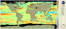
Oceanic Heat Content, Mixed Layer Depth and Depths of 20°C and 26°C Isotherms

Product Families
Ocean Heat Content
Summary

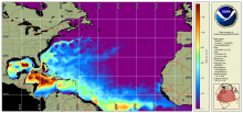
Oceanic Heat Content (OHC) is the measure of the integrated vertical temperature from the sea surface to the depth of the 26°C isotherm and computed from the altimeter-derived isotherm depths in the upper ocean relative to 20°C.  Global 0.25 degree grids are generated daily for OHC, mixed layer depth and depths of 20°C and 26°C isotherms for 3 ocean basins:  North Atlantic, North Pacific and South Pacific 

Sea level Anomaly and Geostrophic Currents, multi-mission, global, optimal interpolation, gridded

Product Families
Ocean Currents
Sea Surface Height
Summary

The NOAA Laboratory for Satellite Altimetry's (LSA) sea surface height team produces 0.25-degree longitude/latitude Level-3 sea level anomaly (SLA) daily datasets by applying optimal interpolation to along-track satellite observations over the global ocean from a constellation of radar altimeter missions. Theses grids are produced with near-real time (3-5 hour latency) data.  Geostrophic Currents are produced from the SLA and are included in the dataset.

Along-track significant wave height, wind speed and sea level anomaly from multiple altimeters

Product Families
Sea Surface Height
Sea Surface Winds
Summary

The NOAA Laboratory for Satellite Altimetry's (LSA) sea surface height team produces 0.25-degree longitude/latitude Level-3 significant wave height, wind speed, and sea level anomaly (SLA) daily datasets by applying optimal interpolation to along-track satellite observations over the global ocean from a constellation of radar altimeter missions. Theses grids are produced with near-real time (3-5 hour latency) data.