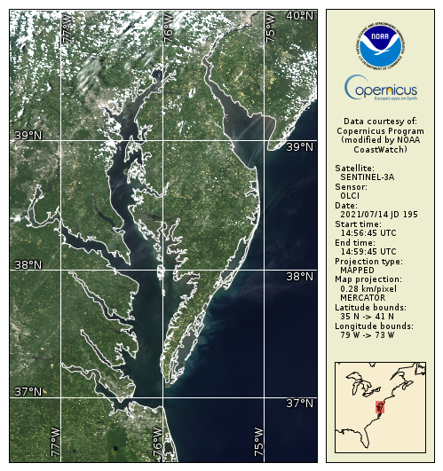
OLCI true color products are generated from atmospheric corrected rho_s bands. Data are available in mapped 300m regions in near real-time CoastWatch HDF format and are compatible with the CoastWatch Utilities.
Data Access
Product Overview
The Sentinels are a suite of satellite missions developed to serve the operational needs of the European Copernicus program for Earth observations. NOAA CoastWatch/OceanWatch provides Sentinel data to US users through official arrangements with ESA, EUMETSAT and the European Commission.
Sentinel-3 is a multi-instrument mission to measure sea- and land-surface temperature, ocean and land color and sea-surface topography. Sentinel-3A was launched on 16 February 2016. Sentinel 3B was launched successfully on 25 April 2018 with the same instruments.
The Ocean and Land Colour Instrument (OLCI) is based on heritage from Envisat’s Medium Resolution Imaging Spectrometer (MERIS to measure visible and thermal infrared radiances, i.e., true color, ocean color and derived parameters such as chlorophyll, total suspended matter (TSM), diffuse attenuation coefficient at 490 nm (Kd(490)), absorption at 443 nm (a(443). OLCI has 21 bands at wavelengths from 400 nm to 1020 nm (400, 412, 442, 490, 510, 560, 620, 665, 674, 681, 709, 754, 779, 865, 885, 1024 nm), a spatial resolution of 300 m and a swath width of 1270 km.
See the ESA Sentinel-3 website for more information: http://www.esa.int/Our_Activities/Observing_the_Earth/Copernicus/Sentinel-3/Introducing_Sentinel-3
OLCI Level 1b (e.g., true color) and ocean color Level 2 data (e.g., radiances, chlorophyll, etc.) are generated by EUMETSAT(https://www.eumetsat.int/website/home/Data/Products/Ocean/index.html) and served by CoastWatch. CoastWatch also generates L3 mapped products for US Coastal regions.
OLCI true color products are generated from atmospheric corrected rho_s bands. Data are available in mapped 300m regions in near real-time CoastWatch HDF format and are compatible with the CoastWatch Utilities. The following variables are within the HDF dataset:
|
latitude |
degrees |
|
longitude |
degrees |
|
rhos_490 |
|
|
rhos_560 |
|
|
rhos_620 |
|
|
graphics |
|
See the EUMETSAT ocean data product pages for more information and links to specific documents: https://www.eumetsat.int/website/home/Data/Products/Ocean/index.html
Product Details
| Short Names |
OLCI True Color
|
|---|---|
| Temporal Start Date |
October 20, 2016
|
| Temporal Coverage |
Near real-time data beginning: |
| Product Families |
True Color Imagery
|
| Measurements |
True Color Imagery (RGB)
|
| Processing Levels |
Level 1
Level 3
|
| Latency Groups |
0 Hours <= 24 Hours (NRT)
|
| Latency Details |
8 hours |
| Spatial Resolution Groups |
100m < 2km
|
| Spatial Resolution Details |
300 m |
| Data Providers |
Copernicus
NOAA
NESDIS
STAR
CoastWatch
|
Spatial Coverage
Global
| Description |
180W - 180E |
|---|
CoastWatch US Regions
| Description |
Also known as the CoastWatch Regional Nodes: OceanWatch Central Pacific, PolarWatch, Great Lakes, East Coast, Atlantic OceanWatch - Caribbean - Gulf of America, WaterWatch (inland rivers), West Coast |
|---|
Platforms
Instruments
OLCI
| Description |
Ocean and Land Colour Instrument |
|---|---|
| Platforms | |
| Instrument Types |
Imager
|
| Organizations |
ESA
|