Ocean Surface Vector Winds (OSVW; magnitude and direction) from the Advanced Scatterometer (ASCAT) on Metop-A, Metop-B, and Metop-C. Metop-A was decommissioned November 15, 2021.
Data Access
| Data Tool Links | |
| Sample Filenames | AS201630004Bas_WW.hdf |
| HTTPS | Products: https://coastwatch.noaa.gov/pub/socd1/coastwatch/products/ascat/ Metop: https://coastwatch.noaa.gov/pub/socd7/coastwatch/metop/ascat/ |
| THREDDS | https://coastwatch.noaa.gov/thredds/socd/coastwatch/catalog_ascat_global_winds.html |
Product Overview
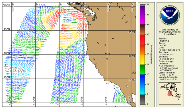
Ocean Surface Vector Winds (OSVW; magnitude and direction) from the Advanced Scatterometer (ASCAT) on Metop-A, Metop-B and Metop-C. Metop-A was decommissioned November 15, 2021.
ASCAT instruments aboard the Meteorological Operational satellite program (MetOp) from EUMETSAT are a series of active microwave sensors used to determine ocean surface level wind vectors through estimation of radar backscatter. The ASCAT sensor data are processed operationally by NOAA OSPO to estimate wind speed and direction in near real with global coverage; products are generated every 4 hours with a spatial resolution of about 25 km. NOAA CoastWatch maps and distributes the OSVW products. See the "information" and "data access" tabs for more.
Product Details
Near real-time + 3 days
Currently stored in and available from our CoastWatch collection:
Metop A from 25 March 2020 to 15 November 2021;
Metop B from 26 March 2020 to present;
Metop C from 3 September 2021 to present
Sea Surface Winds
Less than 24 hours
25 km