An official website of the United States government

Experimental Eddy Products
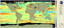
![Example of MESI product [zoomed from global] centered on the Atlantic Ocean.](../sites/default/files/styles/medium/public/2026-03/MESI_v1_multi_global_daily_s20260221_e20260221e8f1.png?itok=9XXZ6a1Z)
The sea surface height team in NOAA’s Laboratory for Satellite Altimetry produces two experimental mesoscale eddy products:
- Multiparameter Eddy Significance Index (MESI)
- MUltiparameter NRT System for Tracking Eddies Retroactively (MUNSTER)