LSA

Laboratory for Satellite Altimetry

Experimental Eddy Products

The sea surface height team in NOAA’s Laboratory for Satellite Altimetry produces two experimental mesoscale eddy products:

  • Multiparameter Eddy Significance Index (MESI)
  • MUltiparameter NRT System for Tracking Eddies Retroactively (MUNSTER)
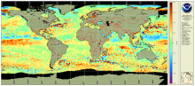
Sea level Anomaly and Geostrophic Currents, multi-mission, global, optimal interpolation, gridded

The NOAA Laboratory for Satellite Altimetry's (LSA) sea surface height team produces 0.25-degree longitude/latitude Level-3 sea level anomaly (SLA) daily datasets by applying optimal interpolation to along-track satellite observations over the global ocean from a constellation of radar altimeter missions. Theses grids are produced with near-real time (3-5 hour latency) data.  Geostrophic Currents are produced from the SLA and are included in the dataset.

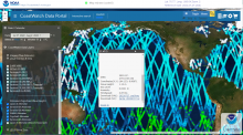
Along-track significant wave height, wind speed and sea level anomaly from multiple altimeters

The NOAA Laboratory for Satellite Altimetry's (LSA) sea surface height team produces 0.25-degree longitude/latitude Level-3 significant wave height, wind speed, and sea level anomaly (SLA) daily datasets by applying optimal interpolation to along-track satellite observations over the global ocean from a constellation of radar altimeter missions. Theses grids are produced with near-real time (3-5 hour latency) data.