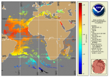
Meteosat
Meteosat
NOAA Geo-Polar Blended Global Sea Surface Temperature Analysis (Level 4)
The NOAA geo-polar blended SST is a daily 0.05° (~5km) global high resolution satellite-based sea surface temperature (SST) Level-4 analyses generated on an operational basis. This analysis combines SST data from US, Japanese and European geostationary infrared imagers, and low-earth orbiting infrared (U.S. and European) SST data, into a single high-resolution 5-km product. The three flavors of blended SST products are night only; day/night, and diurnal warming.
Seviri (MSG) - Geostationary - Level 3
The National Oceanic and Atmospheric Administration's Office of Satellite Data Processing and Distribution are generating operational sea surface temperature (SST) retrievals from the Geostationary Operational Environmental Satellites GOES-East and West. The generation of SSTs began with GOES-8 in 2000 and has continued to be generated through GOES-15


