True Color Imagery

Visible radiances can be combined to form images that look similar to a "photograph" of the earth and ocean from the satellite perspective.

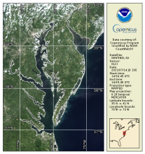
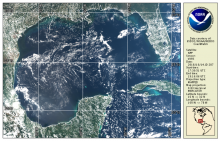
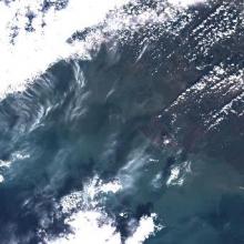
MSI Sentinel-2 Imagery

Product Families
True Color Imagery
Summary

MSI Sentinel-2 high spatial resolution imagery and data from Copernicus are served from CoastWatch for coastal US regions in near real time as the data become available.  JPEG and TIF images as well as zipped Level 1C data are available.

True Color OLCI Sentinel-3A/B

Product Families
True Color Imagery
Summary

OLCI true color products are generated from atmospheric corrected rho_s bands.  Data are available in mapped 300m regions in near real-time CoastWatch HDF format and are compatible with the CoastWatch Utilities. 

True Color VIIRS S-NPP/NOAA-20

Product Families
True Color Imagery
Summary

True color bands are provided from VIIRS on both S-NPP and NOAA-20 VIIRS spacecraft.  These top-of-atmosphere products are generated from the emissive bands (M-bands) for wavelengths corresponding to Red, Green, and Blue and are provided in CoastWatch HDF and PNG daily composite mapped regions