CoastWatch Global Sectors

Description

The 24 sectors identified for file naming convention when referring to VIIRS data. 

Image
Map showing grid of CoastWatch VIIRS Sectors

VIIRS - Sea Ice Concentration, Ice Thickness, Ice Surface Temperature

Product Families
Polar Sea Ice
Summary

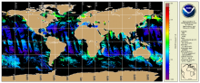
VIIRS Sea Ice Concentration, Sea Ice Thickness and Ice Surface Temperature NOAA CoastWatch/OceanWatch/PolarWatch Level 3, Daily and daily 4-day rolling merged, mapped composites in both polar stereographic projections and CW sector mapped for Northern and Southern hemispheres.

NOAA MSL12 Ocean Color - Science Quality - VIIRS SNPP

Product Families
Ocean Color
Summary

VIIRS Science Quality Ocean Color Level 2 (EDR) is produced by NOAA/STAR Ocean Color Team through NOAA Multi-Sensor Level 1 to Level 2 processing system (MSL12) using an improved calibration for the satellite data record (OC-SDR, which is Level 1b).  CoastWatch Level-3 composites, binned and mapped data products also available.

NOAA CoastWatch co-gridded VIIRS SST from ACSPO

Product Families
Sea Surface Temperature
Summary

NOAA CoastWatch co-gridded VIIRS SST products are Level 3 daily composites in compatible format and projection with other CoastWatch Level 3 sector and global products (such as CoastWatch sector VIIRS ocean color).  Twenty four CoastWatch sector files mapped to equatorial projection that cover the globe (see Description tab for sector definitions) two polar stereographic sectors in 750 m nominal, native resolution and a global, 4 km resolution, single file mapped product is also available. These CoastWatch Level 3 products are generated from ACSPO L2P SST as input.