CoastWatch

CoastWatch

Experimental Eddy Products

The sea surface height team in NOAA’s Laboratory for Satellite Altimetry produces two experimental mesoscale eddy products:

  • Multiparameter Eddy Significance Index (MESI)
  • MUltiparameter NRT System for Tracking Eddies Retroactively (MUNSTER)

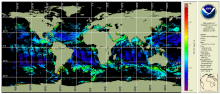
NOAA MSL12 multi-sensor DINEOF global 2 km gap-filled products: Chlorophyll-a, diffuse attenuation coefficient Kd(490), and suspended particulate matter (SPM)

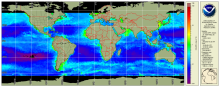
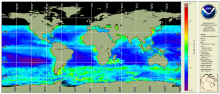
The NOAA Multi-Sensor Level-1 to Level-2 (MSL12) Ocean Color, science quality, multi-sensor 2 km global gap-filled analysis includes chlorophyll-a, Kd(490), and SPM products. These global gap-free data are generated using the data interpolating empirical orthogonal function (DINEOF) method (Liu and Wang, 2023). This product currently uses data from 3 instruments: the Visible Infrared Imaging Radiometer Suite (VIIRS) sensor aboard the Suomi National Polar-orbiting Partnership (SNPP) satellite, VIIRS on the NOAA-20 satellite, plus the Ocean and Land Colour Instrument (OLCI) on the Sentinel 3A satellite from the Copernicus program of the European Union.

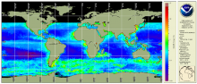
NOAA MSL12 multi-sensor DINEOF global 9km gap-filled products: Chlorophyll-a, diffuse attenuation coefficient Kd(490), and suspended particulate matter (SPM)

The NOAA Multi-Sensor Level-1 to Level-2 (MSL12) Ocean Color, science quality, multi-sensor global gap-filled analysis includes chlorophyll-a, Kd(490), and SPM products. These global gap-free data are generated using the data interpolating empirical orthogonal function (DINEOF) method (Liu and Wang, 2022). The data that go into this product currently come from 3 instruments: the Visible Infrared Imaging Radiometer Suite (VIIRS) sensor aboard the Suomi National Polar-orbiting Partnership (SNPP) satellite, VIIRS on the NOAA-20 satellite, plus the Ocean and Land Colour Instrument (OLCI) on the Sentinel 3A satellite from the Copernicus program of the European Union.

NOAA MSL12 Ocean Color, science quality, VIIRS multi-sensor (SNPP + NOAA-20), chlorophyll DINEOF gap-filled analysis

VIIRS Ocean Color multi-sensor gap-filled analysis (Level 4) is produced with input from the VIIRS multi-sensor (SNPP + NOAA-20) daily merged chlorophyll and monthly climatology using the DINEOF method of interpolation for gap-filling.  The chlorophyll algorithm used is OCI.  The NOAA ocean color science team provides the gap-filled data file to NOAA CoastWatch.  CoastWatch converts these to the NetCDF product and serves them.

Ocean Color - Near Real Time - OLCI Sentinel-3A and 3B Regional Coverage

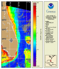
OLCI Sentinel-3A and 3B regional coverage (US coasts of interest, a.k.a. "CONUS" but including Hawaii) Level-3 mapped daily composites of ocean color remote sensing reflectances (Rrs(λ), chlorophyll-a concentration and derived water quality related products including diffuse attenuation coefficient at 490 nm (Kd490),  normalized fluorescence line height (NLFH), and total suspended matter (TSM) from the EUMETSAT processing.

NOAA MSL12 Ocean Color, near real-time, VIIRS multi-sensor (SNPP + NOAA-20), chlorophyll DINEOF gap-filled analysis

VIIRS Ocean Color multi-sensor gap-filled analysis (Level 4) is produced with input from the VIIRS multi-sensor (SNPP + NOAA-20) daily merged chlorophyll and monthly climatology using the DINEOF method of interpolation for gap-filling.  The chlorophyll algoritm used is OCI.  The NOAA ocean color science team provides the gap-filled data file to NOAA CoastWatch.  CoastWatch converts these to the NetCDF product and serves them.

Seascape Pelagic Habitat Classification

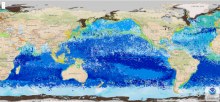
MBON Seascapes identifies spatially explicit water masses with particular biogeochemical features using a model and satellite-derived measurements.  The seascape product is generated as monthly and 8-day composites at 5 km spatial resolution

True Color OLCI Sentinel-3A/B

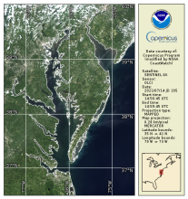
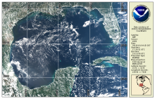
OLCI true color products are generated from atmospheric corrected rho_s bands.  Data are available in mapped 300m regions in near real-time CoastWatch HDF format and are compatible with the CoastWatch Utilities. 

True Color VIIRS S-NPP/NOAA-20

True color bands are provided from VIIRS on both S-NPP and NOAA-20 VIIRS spacecraft.  These top-of-atmosphere products are generated from the emissive bands (M-bands) for wavelengths corresponding to Red, Green, and Blue and are provided in CoastWatch HDF and PNG daily composite mapped regions

Sea Surface Salinity - Near Real Time - MIRAS SMOS

CoastWatch/OceanWatch produces 0.25-degree longitude/latitude Level-3 gridded sea-surface salinity (SSS) daily and 3-day mean datasets by box averaging European Space Agency (ESA) Soil Moisture – Ocean Salinity (SMOS) mission’s Microwave Imaging Radiometer with Aperture Synthesis (MIRAS) satellite observations over the global ocean.