Level-4 data products which are model output or results from analysis of lower level data e.g.variables derived from multiple measurements.
Level 4
NOAA MSL12 multi-sensor DINEOF global 2 km gap-filled products: Chlorophyll-a, diffuse attenuation coefficient Kd(490), and suspended particulate matter (SPM)
The NOAA Multi-Sensor Level-1 to Level-2 (MSL12) Ocean Color, science quality, multi-sensor 2 km global gap-filled analysis includes chlorophyll-a, Kd(490), and SPM products. These global gap-free data are generated using the data interpolating empirical orthogonal function (DINEOF) method (Liu and Wang, 2023). This product currently uses data from 3 instruments: the Visible Infrared Imaging Radiometer Suite (VIIRS) sensor aboard the Suomi National Polar-orbiting Partnership (SNPP) satellite, VIIRS on the NOAA-20 satellite, plus the Ocean and Land Colour Instrument (OLCI) on the Sentinel 3A satellite from the Copernicus program of the European Union.
NOAA MSL12 multi-sensor DINEOF global 9km gap-filled products: Chlorophyll-a, diffuse attenuation coefficient Kd(490), and suspended particulate matter (SPM)
The NOAA Multi-Sensor Level-1 to Level-2 (MSL12) Ocean Color, science quality, multi-sensor global gap-filled analysis includes chlorophyll-a, Kd(490), and SPM products. These global gap-free data are generated using the data interpolating empirical orthogonal function (DINEOF) method (Liu and Wang, 2022). The data that go into this product currently come from 3 instruments: the Visible Infrared Imaging Radiometer Suite (VIIRS) sensor aboard the Suomi National Polar-orbiting Partnership (SNPP) satellite, VIIRS on the NOAA-20 satellite, plus the Ocean and Land Colour Instrument (OLCI) on the Sentinel 3A satellite from the Copernicus program of the European Union.
NOAA NCEI Blended Seawinds (NBS v2)
The NOAA NCEI Blended Seawinds (NBS) version 2.0 dataset synthesizes observations from multiple satellites (up to seven satellites since June 2002) to create gridded wind speeds (10m, neutral). This is an updated version of the existing NOAA NBS v1.0, which is a global gridded 0.25° and 6-hourly sea surface winds product that has wide applications in marine transportation, marine ecosystem and fisheries, offshore winds, weather and ocean forecasts, and other areas.
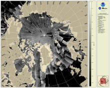
SAR Composite Arctic Imagery (normalized radar cross section)
The daily composite of Synthetic Aperture Radar (SAR) Normalized Radar Cross Section (NRCS) imagery covering the Arctic and sub-Arctic maritime regions over a period of one day are available at 1-km resolution. These high-resolution, weather- and time-agnostic measurements of surface backscatter contain detailed information tailored for sea ice classification purposes.
Oceanic Heat Content, Mixed Layer Depth and Depths of 20°C and 26°C Isotherms
Oceanic Heat Content (OHC) is the measure of the integrated vertical temperature from the sea surface to the depth of the 26°C isotherm and computed from the altimeter-derived isotherm depths in the upper ocean relative to 20°C. Global 0.25 degree grids are generated daily for OHC, mixed layer depth and depths of 20°C and 26°C isotherms for 3 ocean basins: North Atlantic, North Pacific and South Pacific
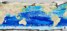
NOAA Geo-Polar Blended Global Sea Surface Temperature Analysis (Level 4)
The NOAA geo-polar blended SST is a daily 0.05° (~5km) global high resolution satellite-based sea surface temperature (SST) Level-4 analyses generated on an operational basis. This analysis combines SST data from US, Japanese and European geostationary infrared imagers, and low-earth orbiting infrared (U.S. and European) SST data, into a single high-resolution 5-km product. The three flavors of blended SST products are night only; day/night, and diurnal warming.
Sea level Anomaly and Geostrophic Currents, multi-mission, global, optimal interpolation, gridded
The NOAA Laboratory for Satellite Altimetry's (LSA) sea surface height team produces 0.25-degree longitude/latitude Level-3 sea level anomaly (SLA) daily datasets by applying optimal interpolation to along-track satellite observations over the global ocean from a constellation of radar altimeter missions. Theses grids are produced with near-real time (3-5 hour latency) data. Geostrophic Currents are produced from the SLA and are included in the dataset.
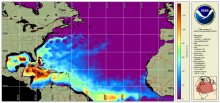
NOAA MSL12 Ocean Color, science quality, VIIRS multi-sensor (SNPP + NOAA-20), chlorophyll DINEOF gap-filled analysis
VIIRS Ocean Color multi-sensor gap-filled analysis (Level 4) is produced with input from the VIIRS multi-sensor (SNPP + NOAA-20) daily merged chlorophyll and monthly climatology using the DINEOF method of interpolation for gap-filling. The chlorophyll algorithm used is OCI. The NOAA ocean color science team provides the gap-filled data file to NOAA CoastWatch. CoastWatch converts these to the NetCDF product and serves them.
NOAA MSL12 Ocean Color, near real-time, VIIRS multi-sensor (SNPP + NOAA-20), chlorophyll DINEOF gap-filled analysis
VIIRS Ocean Color multi-sensor gap-filled analysis (Level 4) is produced with input from the VIIRS multi-sensor (SNPP + NOAA-20) daily merged chlorophyll and monthly climatology using the DINEOF method of interpolation for gap-filling. The chlorophyll algoritm used is OCI. The NOAA ocean color science team provides the gap-filled data file to NOAA CoastWatch. CoastWatch converts these to the NetCDF product and serves them.


