OSPO

Office of Satellite and Product Operations

Oceanic Heat Content, Mixed Layer Depth and Depths of 20°C and 26°C Isotherms
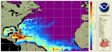
Oceanic Heat Content (OHC) is the measure of the integrated vertical temperature from the sea surface to the depth of the 26°C isotherm and computed from the altimeter-derived isotherm depths in the upper ocean relative to 20°C.  Global 0.25 degree grids are generated daily for OHC, mixed layer depth and depths of 20°C and 26°C isotherms for 3 ocean basins:  North Atlantic, North Pacific and South Pacific 
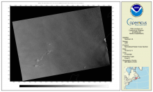
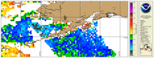
Synthetic Aperture Radar Imagery (NRCS)

Spaceborne Synthetic Aperture Radar (SAR) imagery maps the surface microwave radar reflectivity at resolutions from a sub-meter to 100 m depending on the particular SAR satellite and mode. Since a radar provides its own illumination, imagery is independent of the time of day. At typical radar frequencies, SARs can image through clouds, so SARs are considered "all-weather" instruments.  Several geophysical parameters can be derived from SAR including sea surface wind speed.

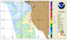
Vector Winds ASCAT Metop-A/B/C

Ocean Surface Vector Winds (OSVW; magnitude and direction) from the Advanced Scatterometer (ASCAT) on Metop-A, Metop-B, and Metop-C.  Metop-A was decommissioned November 15, 2021.

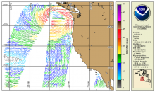
Synthetic Aperture Radar (Surface Roughness) Winds

Spaceborne Synthetic Aperture Radar (SAR) imagery maps the surface microwave radar reflectivity at resolutions from a sub-meter to 100 m depending on the particular SAR satellite and mode. Since a radar provides its own illumination, imagery is independent of the time of day. At typical radar frequencies, SARs can image through clouds, so SARs are considered "all-weather" instruments.  Several geophysical parameters can be derived from SAR including sea surface wind speed.

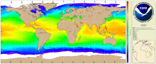
NOAA Geo-Polar Blended Global Sea Surface Temperature Analysis (Level 4)

The NOAA geo-polar blended SST is a daily 0.05° (~5km) global high resolution satellite-based sea surface temperature (SST) Level-4 analyses generated on an operational basis. This analysis combines SST data from US, Japanese and European geostationary infrared imagers, and low-earth orbiting infrared (U.S. and European) SST data, into a single high-resolution 5-km product.  The three flavors of blended SST products are night only; day/night, and diurnal warming. 

AMSR2 - Sea Ice Concentration

NOAA CoastWatch / OceanWatch / PolarWatch Sea Ice Concentration, Level 3, daily and daily 4-day rolling merge, polar stereographic mapped composites -  AMSR-2

Seviri (MSG) - Geostationary - Level 3

The National Oceanic and Atmospheric Administration's Office of Satellite Data Processing and Distribution are generating operational sea surface temperature (SST) retrievals from the Geostationary Operational Environmental Satellites GOES-East and West. The generation of SSTs began with GOES-8 in 2000 and has continued to be generated through GOES-15