An official website of the United States government
Official websites use .gov A .gov website belongs to an official government organization in the United States.
Secure .gov websites use HTTPS A lock ? or https:// means you’ve safely connected to the .gov website. Share sensitive information only on official, secure websites..
The sea surface height team in NOAA’s Laboratory for Satellite Altimetry developed two experimental mesoscale eddy products:
Multiparameter Eddy Significance Index (MESI)
MUltiparameter NRT System for Tracking Eddies Retroactively (MUNSTER)
AOML, CIMAS, and CoastWatch have developed an initial version of a hurricane-ocean database and display for all Atlantic tropical cyclones during 2003-2022
The NOAA Advanced Clear-Sky Processor for Ocean (ACSPO) L3S-LEO-PM and L3S-LEO-DY products will be updated from ACSPO v2.80 to ACSPO v2.81 on October 2, 2023.
The Joint Polar Satellite System (JPSS) has approved NOAA-21 Visible Infrared Imaging Radiometer Suite (VIIRS) Advanced Clear Sky Processor for Ocean (ACSPO) sea surface temperature (SST) products for Provisional Maturity
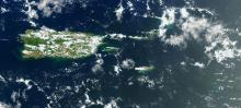
A Frequently Asked Questions (FAQs) for Sargassum was composed by the NOAA Atlantic Oceanographic & Meteorological Laboratory (AOML) in partnership with NOAA CoastWatch Caribbean, Gulf of America, and Atlantic OceanWatch Node.
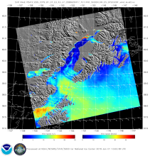
The West Coast Node (WCN) of CoastWatch is home to thousands of datasets; from ACSPO SST to Vector Winds, their ERDDAP server stores decades of historic climate data. But one group of products stands out with its impact on the coastal communities of California and Southern Oregon: C-HARM.
Communication of scientific information and data to the public is part of NOAA’s mission, and scientific visualization is often the public’s first encounter with the agency’s data. This post gives an overview of recent advances and considerations for selecting and improving color selection for remote sensing data. NOAA CoastWatch will be experimenting with different colors for its data presentations.
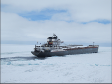
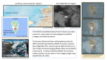
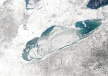
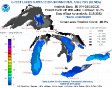
In order to understand ice formation and the types of ice in the Great Lakes, the NOAA Great Lakes Environmental Research Laboratory (GLERL) and the U.S. Coast Guard use Synthetic Aperture Radar (SAR) data from the NOAA CoastWatch Great Lakes Node to monitor six different types of ice, ice thickness, and ice cover.
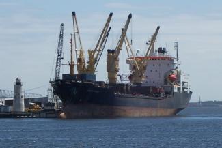
Synthetic Aperture Radar (SAR) is an active radar satellite instrument that transmits microwave pulses that bounce off the Earth’s surface. The radar signals are then processed into imagery that can be used to derive several geographic and non-geographic features including: wind speeds, oil spills, sea ice and ship detection.
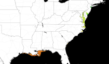
As sea temperatures rise, lethal Vibrio bacteria species populations are growing. The NOAA CoastWatch Caribbean and Gulf of America regional node at AOML has developed a model to predict Vibrio habitat suitability on a global scale.
Meteorologists at the Cleveland Weather Forecast Office tell a story exemplifying how CoastWatch data supports their mission, and how accurate predictions can save lives.